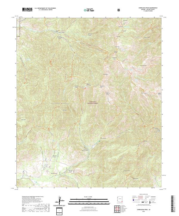
2021 Map of Chiricahua Peak
USGS Topo · Published 2021About this map
Chiricahua Peak stands as the literal and topographic centerpiece of this high-elevation survey within the Coronado National Forest. This section of the Chiricahua Mountains is defined by a dense network of drainages and ridgelines, where numerous high summits like Monte Vista Peak and Snowshed Peak overlook a complex system of trails. The landscape reveals a heavy reliance on foot and pack travel, with established routes such as the Mormon Canyon Trl and Crest Trl connecting various saddles and parks.
Find a feature on this map
81 named features on this map. Tap any name to fly to it.
Don’t see what you’re looking for? This feature index may not catch every label — zoom into the map to look around manually.
Map Details
Editions of this 2021 Chiricahua Peak Map
This is the sole edition of this map. No revisions or reprints were ever made.
Other maps of this area

1917 · Chiricahua
USGS Topo · 1:125,000

1919 · Chiricahua
USGS Topo · 1:125,000

1926 · Rodeo
USGS Topo · 1:62,500

1926 · Rucker
USGS Topo · 1:62,500

1926 · Pedregosa
USGS Topo · 1:62,500

1940 · Apache
USGS Topo · 1:62,500

1955 · Douglas
USGS Topo · 1:250,000

1958 · Chiricahua Peak
USGS Topo · 1:62,500

1958 · Apache
USGS Topo · 1:62,500
1958 · Pedregosa Mountains
USGS Topo · 1:62,500