
1905 Map of Chisos Mountains
USGS Topo · Published 1940About this map
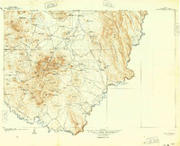
The Chisos Mountains rise as the central focal point of this Brewster County landscape, surveyed at the dawn of the twentieth century. The terrain is marked by a network of isolated outposts and livestock operations including Stroud's Ranch, Solis Ranch, and Stillwell's Ranch, connected by rugged paths like the Straw House Trail. Along the sweeping southern bend of the Rio Grande, the map documents international border points and early industrial sites such as the Old Smelter and Lindsey's Mine. These features, along with specialized landmarks like Smallpox Spring and Reed Camp, illustrate the sparse but determined settlement pattern of the Trans-Pecos frontier during an era of mining and ranching expansion.
Find a feature on this map
122 named features on this map. Tap any name to fly to it.
Don’t see what you’re looking for? This feature index may not catch every label — zoom into the map to look around manually.
Map Details
Editions of this 1905 Chisos Mountains Map
2 editions found
Other maps of this area

1903 · Chisos Mountains
USGS Topo · 1:125,000

1903 · Terlingua
USGS Topo · 1:125,000

1904 · Terlingua
USGS Topo · 1:125,000

1917 · Agua Fria
USGS Topo · 1:62,500

1917 · Bone Spring
USGS Topo · 1:62,500

1918 · Bone Spring
USGS Topo · 1:125,000

1918 · Bone Spring
USGS Topo · 1:62,500

1918 · Nine Point Mesa
USGS Topo · 1:62,500

1919 · Maravillas Canyon
USGS Topo · 1:62,500

1920 · Bone Spring
USGS Topo · 1:62,500