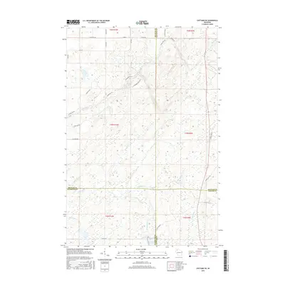
2015 Map of Chittamo NE
USGS Topo · Published 2015About this map
The Totagatic River and its accompanying Totagatic Flowage dominate the southern portion of this landscape, marking a complex drainage system where the borders of Douglas, Bayfield, Washburn, and Sawyer counties converge. The terrain is characterized by a dense network of watercourses, including the Ounce River, Williamson Cr, and Black Brook, flowing through the Northwoods. A distinct system of forest roads and trails, such as Coppermine Scenic Dr Lp and the Jack Pine Loop, suggests a region utilized for timber management and outdoor recreation. Toward the northeast, Goose Lake sits in a pocket of land north of the Ounce River, while curiosities like Camp Eatmore Rd and Rabbit Hatch Rd reflect the local nomenclature of the hunting and fishing camps that historically define the area's human footprint.
Find a feature on this map
42 named features on this map. Tap any name to fly to it.
Don’t see what you’re looking for? This feature index may not catch every label — zoom into the map to look around manually.
Map Details
Editions of this 2015 Chittamo NE Map
This is the sole edition of this map. No revisions or reprints were ever made.
Other maps of this area

1944 · Drummond
USGS Topo · 1:48,000

1944 · Hayward
USGS Topo · 1:48,000

1945 · Highland
USGS Topo · 1:48,000

1947 · Drummond
USGS Topo · 1:48,000

1947 · Chittamo
USGS Topo · 1:48,000

1949 · Chittamo
USGS Topo · 1:48,000

1949 · Highland
USGS Topo · 1:48,000

1953 · Ashland
USGS Topo · 1:250,000

1958 · Ashland
USGS Topo · 1:250,000
1961 · Ellison Lake
USGS Topo · 1:62,500