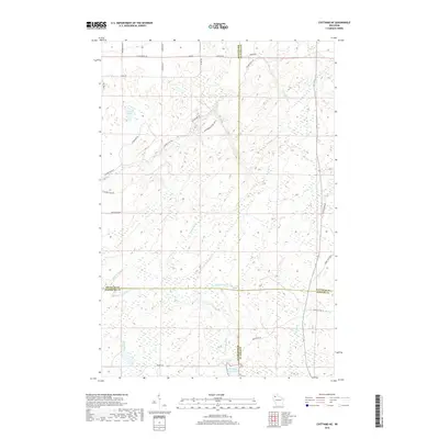
2018 Map of Chittamo NE
USGS Topo · Published 2018About this map
The Totagatic River and its accompanying Totagatic Flowage anchor this landscape where Douglas, Bayfield, Washburn, and Sawyer counties meet. This hydrologically dense region is defined by a network of drainage streams including Ounce River, Black Brook, and Haymaker Cr, reflecting the glacial legacy of Northern Wisconsin. The road network suggests a history of forest management and recreational land use, featuring uniquely named routes such as Rabbit Hatch Rd, Camp Eatmore Rd, and the Coppermine Scenic Dr Lp. Smaller water bodies like Goose Lake are scattered throughout the quadrangle, illustrating the complex wetland and tributary systems that feed into the larger river basins. The prevalence of fire lanes, including W Seeley Fire Ln, points to the ongoing management of this densely wooded intersection of four different county jurisdictions.
Find a feature on this map
36 named features on this map. Tap any name to fly to it.
Don’t see what you’re looking for? This feature index may not catch every label — zoom into the map to look around manually.
Map Details
Editions of this 2018 Chittamo NE Map
This is the sole edition of this map. No revisions or reprints were ever made.
Other maps of this area

1944 · Drummond
USGS Topo · 1:48,000

1944 · Hayward
USGS Topo · 1:48,000

1945 · Highland
USGS Topo · 1:48,000

1947 · Drummond
USGS Topo · 1:48,000

1947 · Chittamo
USGS Topo · 1:48,000

1949 · Chittamo
USGS Topo · 1:48,000

1949 · Highland
USGS Topo · 1:48,000

1953 · Ashland
USGS Topo · 1:250,000

1958 · Ashland
USGS Topo · 1:250,000
1961 · Ellison Lake
USGS Topo · 1:62,500