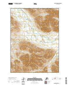
2018 Map of Christian D-6 NW
USGS Topo · Published 2018About this map
Wind River carves a meandering path through this interior Alaskan landscape, creating a complex wetland environment of oxbows and unnamed tributaries. The northern reaches of the Yukon-Koyukuk Borough are defined by the sharp transition between these low-lying drainage basins and the high elevations of the Keche Mountains. In the western portion of the quadrangle, Big Ram Lake sits within a concentrated cluster of smaller water bodies, illustrating the glacial and permafrost-influenced hydrology typical of this subarctic region. The topographic detail highlights the prominent peak of Keche Mtn in the east, which rises abruptly from the surrounding river valley. This 2018 survey provides an essential view of a remote wilderness area where natural landforms and water systems remain the primary features of the land.
Find a feature on this map
13 named features on this map. Tap any name to fly to it.
Don’t see what you’re looking for? This feature index may not catch every label — zoom into the map to look around manually.
Map Details
Editions of this 2018 Christian D-6 NW Map
This is the sole edition of this map. No revisions or reprints were ever made.
Other maps of this area

1951 · Chandalar
USGS Topo · 1:250,000

1951 · Christian
USGS Topo · 1:250,000

1951 · Brooks
USGS Topo · 1:250,000

1951 · Arctic
USGS Topo · 1:250,000

1956 · Arctic
USGS Topo · 1:250,000

1956 · Chandalar
USGS Topo · 1:250,000

1956 · Philip Smith Mountains
USGS Topo · 1:250,000

1956 · Christian
USGS Topo · 1:250,000

1964 · Chandalar
USGS Topo · 1:250,000

1964 · Philip Smith Mountains
USGS Topo · 1:250,000