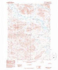
1990 Map of Christian D-6
USGS Topo · Published 1990About this map
The Arctic National Wildlife Refuge dominates this interior Alaska landscape, as recorded in a 1990 provisional study. The terrain is defined by the massive profile of Keche Mountain and the winding course of the Wind River as it flows south through the central corridor. Established boundaries from the 1980 Alaska National Interest Lands Conservation Act are integrated here, mapping a wilderness devoid of roads or settlements. High-elevation features like Big Ram Lake and the headwaters of Smoke Creek are documented through aerial photography from the 1970s and 1980, providing a precise topographic record of this protected subarctic environment before the close of the twentieth century.
Find a feature on this map
5 named features on this map. Tap any name to fly to it.
Don’t see what you’re looking for? This feature index may not catch every label — zoom into the map to look around manually.
Map Details
Editions of this 1990 Christian D-6 Map
This is the sole edition of this map. No revisions or reprints were ever made.
Other maps of this area

1951 · Chandalar
USGS Topo · 1:250,000

1951 · Christian
USGS Topo · 1:250,000

1951 · Brooks
USGS Topo · 1:250,000

1951 · Arctic
USGS Topo · 1:250,000

1956 · Arctic
USGS Topo · 1:250,000

1956 · Chandalar
USGS Topo · 1:250,000

1956 · Philip Smith Mountains
USGS Topo · 1:250,000

1956 · Christian
USGS Topo · 1:250,000

1964 · Chandalar
USGS Topo · 1:250,000

1964 · Philip Smith Mountains
USGS Topo · 1:250,000