2022 Map of Christine West
USGS Topo · Published 2022About this map
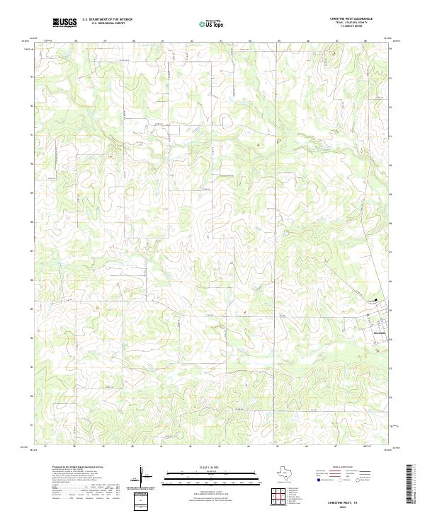
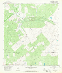
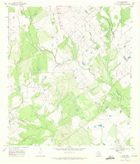
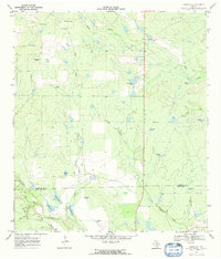
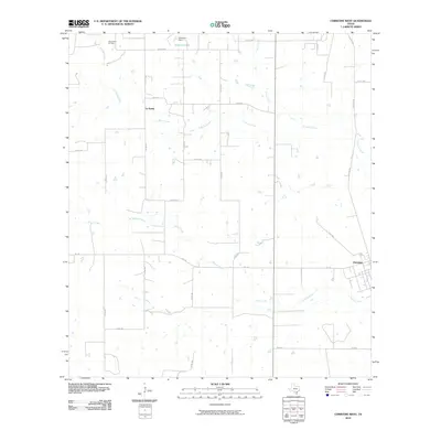
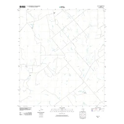
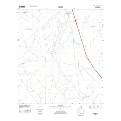
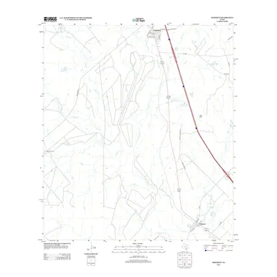
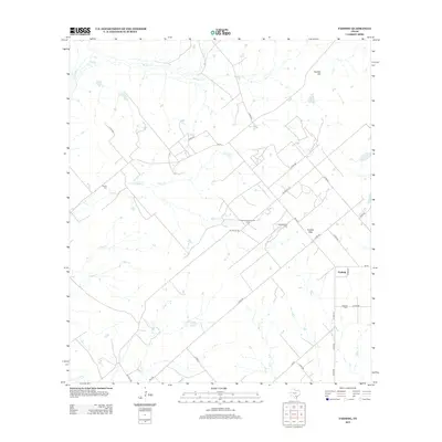
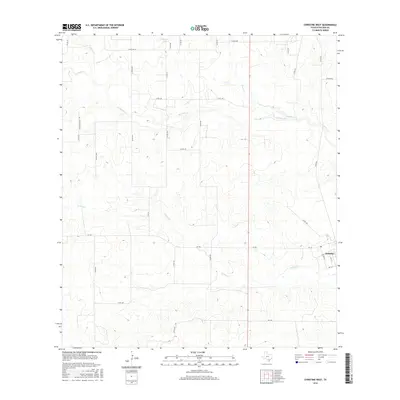
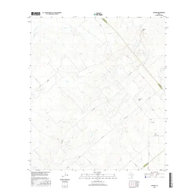
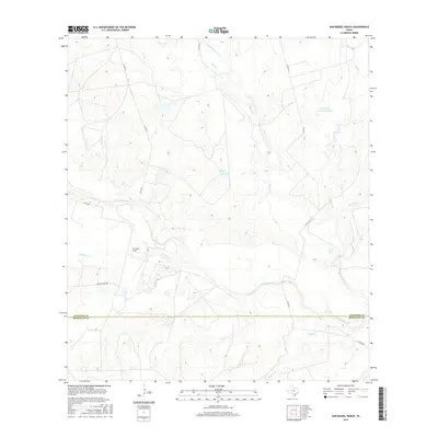
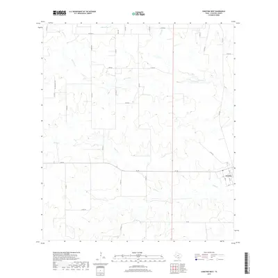
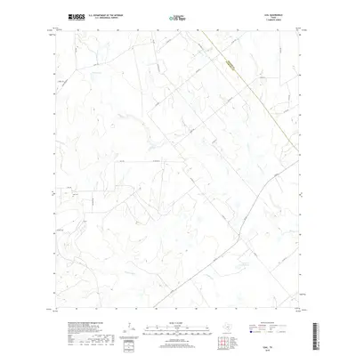
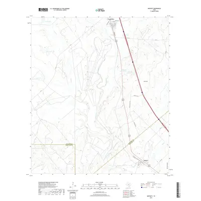
The settlement of Christine anchors the eastern edge of this Atascosa County landscape, showing a grid of residential streets including I Ave and Ave O near the Christine City Cem. The surrounding terrain is defined by a dense network of intermittent drainage systems, notably the branching paths of Turkey Cr, La Parita Cr, and Goose Cr. This 2022 survey illustrates the modern rural infrastructure of the region, where numerous county roads like La Parita Rd and Buchschultz Trl connect isolated ranching or agricultural properties. At the northern boundary, Schorsch Lake serves as a significant local water feature. The map provides a clear look at the spatial relationship between the town center and the surrounding creek valleys, tracing the winding transition from developed plots to the open ranch land characteristic of South Texas.
Find a feature on this map
38 named features on this map. Tap any name to fly to it.
Don’t see what you’re looking for? This feature index may not catch every label — zoom into the map to look around manually.
Map Details
Editions of this 2022 Christine West Map
This is the sole edition of this map. No revisions or reprints were ever made.
Historical Maps of Christine Through Time
68 maps found
1930 Whitsett
Atascosa County, TX
1942 Whitsett
Atascosa County, TX
1961 Fashing
Atascosa County, TX
1965 Caballos Creek
Atascosa County, TX
1965 Whitsett
Atascosa County, TX
1968 Christine West
Atascosa County, TX
1968 Dobrowolski
Atascosa County, TX
1968 Leal
Atascosa County, TX
1968 McCoy
Atascosa County, TX
1968 Rossville
Atascosa County, TX
1969 Christine East
Atascosa County, TX
1969 Cross NE
Atascosa County, TX
1969 San Miguel Ranch
Atascosa County, TX
2010 Caballos Creek
Atascosa County, TX
2010 Christine East
Atascosa County, TX
2010 Christine West
Atascosa County, TX
2010 Cross NE
Atascosa County, TX
2010 Dobrowolski
Atascosa County, TX
2010 Fashing
Atascosa County, TX
2010 Leal
Atascosa County, TX
2010 McCoy
Atascosa County, TX
2010 Rossville
Atascosa County, TX
2010 San Miguel Ranch
Atascosa County, TX
2010 Whitsett
Atascosa County, TX

2012 Christine East
Atascosa County, TX
2012 Dobrowolski
Atascosa County, TX
2012 Leal
Atascosa County, TX
2012 McCoy
Atascosa County, TX
2012 Whitsett
Atascosa County, TX
2013 Caballos Creek
Atascosa County, TX
2013 Christine West
Atascosa County, TX
2013 Cross NE
Atascosa County, TX
2013 Fashing
Atascosa County, TX
2013 Rossville
Atascosa County, TX
2013 San Miguel Ranch
Atascosa County, TX
2016 Caballos Creek
Atascosa County, TX
2016 Christine East
Atascosa County, TX
2016 Christine West
Atascosa County, TX
2016 Cross NE
Atascosa County, TX
2016 Dobrowolski
Atascosa County, TX
2016 Fashing
Atascosa County, TX
2016 Leal
Atascosa County, TX
2016 McCoy
Atascosa County, TX
2016 Rossville
Atascosa County, TX
2016 San Miguel Ranch
Atascosa County, TX
2016 Whitsett
Atascosa County, TX
2019 Caballos Creek
Atascosa County, TX
2019 Christine East
Atascosa County, TX
2019 Christine West
Atascosa County, TX
2019 Cross NE
Atascosa County, TX
2019 Dobrowolski
Atascosa County, TX
2019 Fashing
Atascosa County, TX
2019 Leal
Atascosa County, TX
2019 McCoy
Atascosa County, TX
2019 Rossville
Atascosa County, TX
2019 San Miguel Ranch
Atascosa County, TX
2019 Whitsett
Atascosa County, TX
2022 Caballos Creek
Atascosa County, TX
2022 Christine East
Atascosa County, TX
2022 Christine West
Atascosa County, TX
2022 Cross NE
Atascosa County, TX
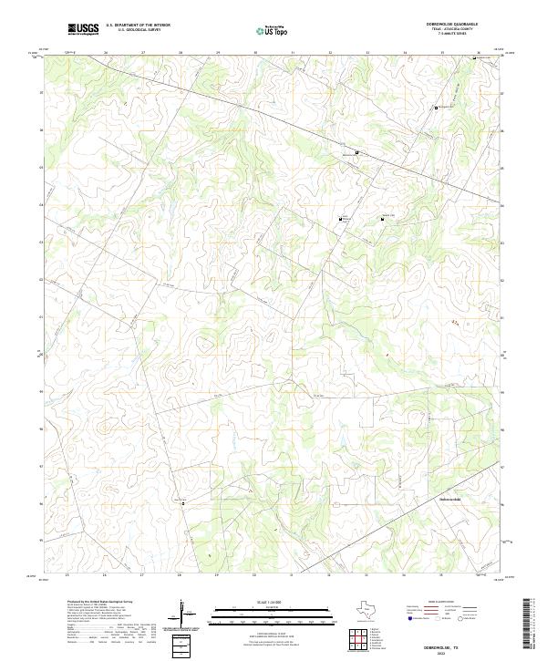
2022 Dobrowolski
Atascosa County, TX
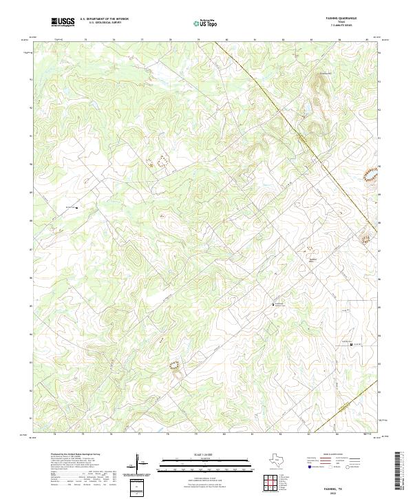
2022 Fashing
Atascosa County, TX
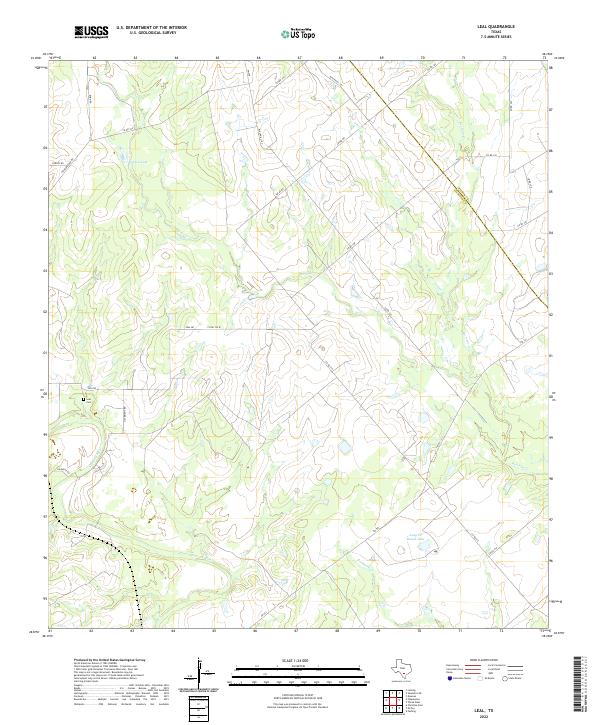
2022 Leal
Atascosa County, TX
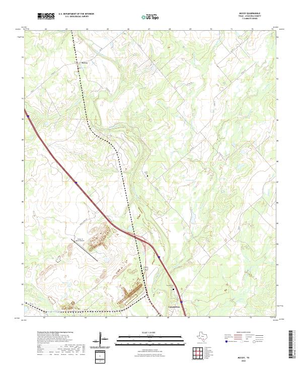
2022 McCoy
Atascosa County, TX
2022 Rossville
Atascosa County, TX
2022 San Miguel Ranch
Atascosa County, TX
2022 Whitsett
Atascosa County, TX