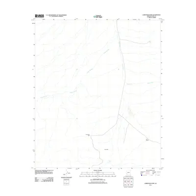
2011 Map of Christmas Pass
USGS Topo · Published 2011About this map
Christmas Pass serves as a central topographic landmark in this arid portion of Yuma County, marking a natural corridor between rising landforms. The landscape is defined by the broad expanse of the Tule Desert to the southeast and the undulating terrain of the Drift Hills. Water management in this desert environment is evidenced by the placement of infrastructure like North Pinta Tank and Senita Tank, which provided essential water collection points in a region dominated by ephemeral drainage systems. The intricate network of seasonal waterways, including the extensive Mohawk Wash and Smoke Tree Wash, illustrates the alluvial drainage patterns that shape the local geography. This survey provides a precise look at the land before subsequent environmental shifts, recording the location of remote landmarks critical for desert navigation and resource tracking.
Find a feature on this map
7 named features on this map. Tap any name to fly to it.
Don’t see what you’re looking for? This feature index may not catch every label — zoom into the map to look around manually.
Map Details
Editions of this 2011 Christmas Pass Map
This is the sole edition of this map. No revisions or reprints were ever made.
Other maps of this area

1953 · Ajo
USGS Topo · 1:250,000

1957 · Ajo
USGS Topo · 1:250,000

1958 · Ajo
USGS Topo · 1:250,000

1962 · Ajo
USGS Topo · 1:250,000

1963 · Ajo
USGS Topo · 1:250,000

1965 · Cabeza Prieta Peak
USGS Topo · 1:62,500
1965 · Tule Mountains
USGS Topo · 1:62,500

1965 · Isla Pinta
USGS Topo · 1:62,500

1965 · Sierra Arida
USGS Topo · 1:62,500

1967 · Ajo
USGS Topo · 1:250,000