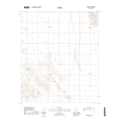
2018 Map of Christmas Pass
USGS Topo · Published 2018About this map
Christmas Pass serves as a critical point of navigation through the arid reaches of Yuma County, marking a natural corridor between the high ridges of the Cabeza Prieta Mountains and the Drift Hills. This 2018 survey reveals a landscape where water management is essential for survival, indicated by the presence of isolated catchments such as North Pinta Tank and Senita Tank. The terrain transitions from the jagged peaks of the Sierra Pinta down toward the wide expanse of the Tule Desert. Ephemeral drainage systems, including Mohawk Wash and Smoke Tree Wash, carve through the basin floor, illustrating the geological processes that shape this corner of the desert. The map provides an essential view of the Public Land Survey System grid across these remote townships, detailing the precise topographic relief and the few improved routes that cross this sparsely populated region.
Find a feature on this map
13 named features on this map. Tap any name to fly to it.
Don’t see what you’re looking for? This feature index may not catch every label — zoom into the map to look around manually.
Map Details
Editions of this 2018 Christmas Pass Map
This is the sole edition of this map. No revisions or reprints were ever made.
Other maps of this area

1953 · Ajo
USGS Topo · 1:250,000

1957 · Ajo
USGS Topo · 1:250,000

1958 · Ajo
USGS Topo · 1:250,000

1962 · Ajo
USGS Topo · 1:250,000

1963 · Ajo
USGS Topo · 1:250,000

1965 · Cabeza Prieta Peak
USGS Topo · 1:62,500
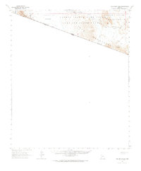
1965 · Tule Mountains
USGS Topo · 1:62,500

1965 · Isla Pinta
USGS Topo · 1:62,500

1965 · Sierra Arida
USGS Topo · 1:62,500

1967 · Ajo
USGS Topo · 1:250,000