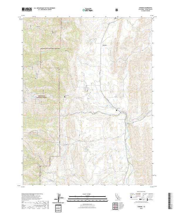
2021 Map of Chrome
USGS Topo · Published 2021About this map
Chrome and its surrounding ranchlands in Glenn County are defined by the transition from the valley floor into the eastern foothills of the Mendocino National Forest. This modern record of the landscape highlights several markers of local heritage, most notably the Chrome Cem and Grindstone Cem, alongside the specifically identified Watson Grave. These sites reflect the long-standing rural community established along the base of Rocky Ridge. Water management is central to the area's geography, with the flow of Grindstone Creek and Stony Creek intersecting a network of county roads like Co Rd 306. In the higher elevations to the west, features like Red Mtn and Bald Hill overlook East Reservoir and Dry Lake Reservoir, illustrating the rugged topography that borders the national forest boundary.
Find a feature on this map
36 named features on this map. Tap any name to fly to it.
Don’t see what you’re looking for? This feature index may not catch every label — zoom into the map to look around manually.
Map Details
Editions of this 2021 Chrome Map
This is the sole edition of this map. No revisions or reprints were ever made.
Other maps of this area

1919 · Fruto
USGS Topo · 1:62,500

1919 · Elk Creek
USGS Topo · 1:62,500

1944 · Fruto
USGS Topo · 1:62,500

1944 · Flournoy
USGS Topo · 1:62,500

1948 · Elk Creek
USGS Topo · 1:62,500

1952 · Paskenta
USGS Topo · 1:62,500

1957 · Elk Creek
USGS Topo · 1:62,500

1957 · Ukiah
USGS Topo · 1:250,000
1958 · Fruto
USGS Topo · 1:62,500
1958 · Flournoy
USGS Topo · 1:62,500