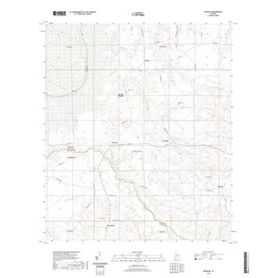
2020 Map of Chrysler
USGS Topo · Published 2020About this map
The Alabama River and its dense network of tributaries form the backbone of this coastal plain landscape along the border of Baldwin, Monroe, and Clarke counties. Early twentieth-century settlement patterns remain visible in the placement of small communities like Chrysler, Eliska, and Mount Pleasant. The proximity to the river is evident at Potts Bar and Potts Bayou, where the low-lying terrain gives way to an intricate system of creeks including Shomo Cr, Walker Cr, and Little Nancey Br.
Find a feature on this map
58 named features on this map. Tap any name to fly to it.
Don’t see what you’re looking for? This feature index may not catch every label — zoom into the map to look around manually.
Map Details
Editions of this 2020 Chrysler Map
This is the sole edition of this map. No revisions or reprints were ever made.
Other maps of this area

1942 · Perdido
USGS Topo · 1:62,500

1943 · Choctaw Bluff
USGS Topo · 1:62,500

1943 · Tensaw
USGS Topo · 1:62,500

1944 · Tensaw
USGS Topo · 1:62,500

1944 · Perdido
USGS Topo · 1:62,500

1946 · Choctaw Bluff
USGS Topo · 1:62,500

1953 · Andalusia
USGS Topo · 1:250,000

1957 · Andalusia
USGS Topo · 1:250,000

1972 · Chrysler
USGS Topo · 1:24,000

1972 · Uriah West
USGS Topo · 1:24,000