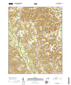
2019 Map of Church View
USGS Topo · Published 2019About this map
Dragon Swamp and its associated wetlands form the winding western boundary of this Virginia coastal plain landscape, dividing Middlesex County from King and Queen County. The settlement pattern follows the high ground along the Tidewater Trl, where small crossroads communities like Jamaica and Church View serve as local anchors. This modern survey illustrates a region deeply connected to its rural heritage, with numerous burial grounds such as Glebe Landing Cem and Saint Pauls Cem scattered near older parish sites. The landscape is characterized by a dense network of watercourses, including Parrotts Creek and Lagrange Creek, which drain into the Chesapeake's larger tidal systems. These creeks are often buffered by extensive wooded swamps like Briery Swamp and Nickleberry Swamp, limiting development to the well-drained ridges where hamlets like Samos and Warner persist.
Find a feature on this map
90 named features on this map. Tap any name to fly to it.
Don’t see what you’re looking for? This feature index may not catch every label — zoom into the map to look around manually.
Map Details
Editions of this 2019 Church View Map
This is the sole edition of this map. No revisions or reprints were ever made.
Other maps of this area

1917 · Urbanna
USGS Topo · 1:62,500

1917 · Morattico
USGS Topo · 1:62,500

1918 · Tappahannock
USGS Topo · 1:62,500

1918 · Morattico
USGS Topo · 1:62,500

1919 · New Kent
USGS Topo · 1:62,500

1919 · Tappahannock
USGS Topo · 1:62,500

1926 · Morattico
USGS Topo · 1:62,500

1943 · Richmond
USGS Topo · 1:250,000

1944 · Dunnsville
USGS Topo · 1:31,680

1944 · Morattico
USGS Topo · 1:31,680