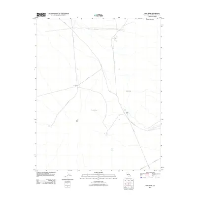
2012 Map of Cima Dome
USGS Topo · Published 2012About this map
Cima Dome dominates this arid high-desert landscape in northeastern San Bernardino County, where volcanic geography meets isolated ranching outposts. This 2012 survey documents a sparsely populated region defined by historical water sources and elevation peaks. Isolated ranch sites such as Valley View Ranch and Kessler Ranch are connected by a network of unimproved desert roads including Deer Spring Rd and Cima Rd. The presence of several named water features, such as Ord Tank, Kessler Spring, and White Rock Spring, highlights the critical importance of localized hydrology in this dry environment. Elevated landmarks like Teutonia Peak and Kessler Peak rise above the desert floor, with the northern reaches of the Ivanpah Mountains appearing on the northeastern edge of the sheet. The map illustrates a modern era of land use where historic grazing routes like Ivanpah Cima Rd persist alongside utility corridors like Powerline Rd.
Find a feature on this map
18 named features on this map. Tap any name to fly to it.
Don’t see what you’re looking for? This feature index may not catch every label — zoom into the map to look around manually.
Map Details
Editions of this 2012 Cima Dome Map
This is the sole edition of this map. No revisions or reprints were ever made.
Other maps of this area

1910 · Ivanpah
USGS Topo · 1:250,000

1912 · Ivanpah
USGS Topo · 1:250,000

1942 · Ivanpah
USGS Topo · 1:250,000

1947 · Kingman
USGS Topo · 1:250,000

1948 · Kingman
USGS Topo · 1:250,000

1954 · Kingman
USGS Topo · 1:250,000

1955 · Kingman
USGS Topo · 1:250,000

1955 · Mescal Range
USGS Topo · 1:62,500

1955 · Mid Hills
USGS Topo · 1:62,500

1955 · Kelso
USGS Topo · 1:62,500