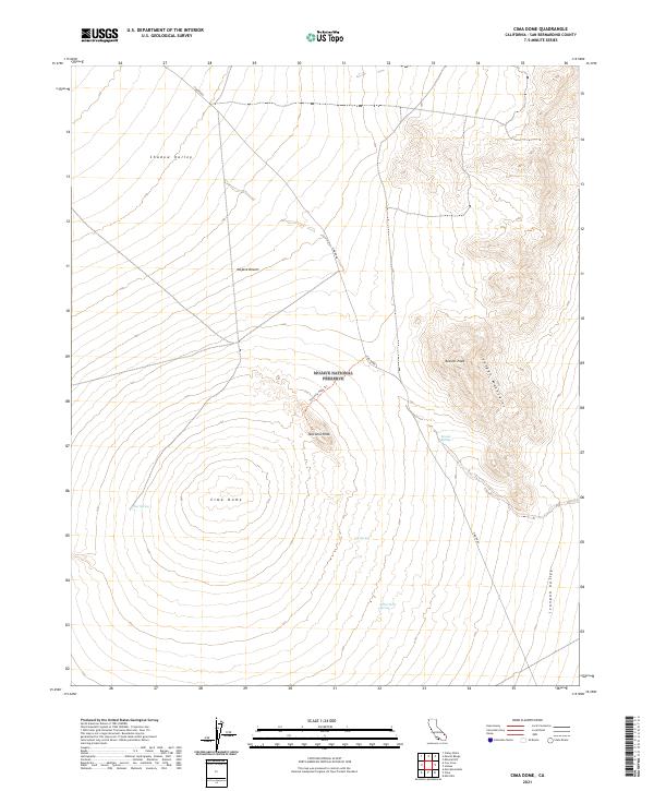
2021 Map of Cima Dome
USGS Topo · Published 2021About this map
The Mojave National Preserve contains the remarkable symmetric rise of Cima Dome, a geologically significant landform that dominates the western half of this 2021 survey. To the northeast, the terrain transitions into the steep slopes of the Ivanpah Mountains, where Kessler Peak stands as a prominent high point. This arid landscape is marked by the vital presence of several water sources, including Deer Spring, Kessler Spring, and White Rock Spring, which historically supported movement through the desert.
Find a feature on this map
18 named features on this map. Tap any name to fly to it.
Don’t see what you’re looking for? This feature index may not catch every label — zoom into the map to look around manually.
Map Details
Editions of this 2021 Cima Dome Map
This is the sole edition of this map. No revisions or reprints were ever made.
Other maps of this area

1910 · Ivanpah
USGS Topo · 1:250,000

1912 · Ivanpah
USGS Topo · 1:250,000

1942 · Ivanpah
USGS Topo · 1:250,000

1947 · Kingman
USGS Topo · 1:250,000

1948 · Kingman
USGS Topo · 1:250,000

1954 · Kingman
USGS Topo · 1:250,000

1955 · Kingman
USGS Topo · 1:250,000

1955 · Mescal Range
USGS Topo · 1:62,500

1955 · Mid Hills
USGS Topo · 1:62,500

1955 · Kelso
USGS Topo · 1:62,500