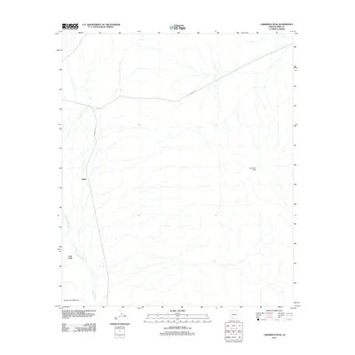
2011 Map of Cimarron Peak
USGS Topo · Published 2011About this map
Emika and Tatai Toak anchor this high-desert landscape in Pima County, where the topography is defined by the prominent Cimarron Peak and Roadrunner Mountain. The area’s geography is shaped by the ephemeral drainage of Hickiwan Wash, which threads through the arid terrain. Transportation and infrastructure are represented by Indian Rte 13, which runs north-south through the western portion of the quadrangle, and Pipeline Rd, cutting diagonally across the northern reaches. This 2011 survey illustrates the modern configuration of rural roads and land use in this specific corner of the Sonoran desert before subsequent developments. The sparse settlement pattern around these named sites provides a clear look at the spatial relationship between isolated peaks and the seasonal watercourses that define the region.
Find a feature on this map
7 named features on this map. Tap any name to fly to it.
Don’t see what you’re looking for? This feature index may not catch every label — zoom into the map to look around manually.
Map Details
Editions of this 2011 Cimarron Peak Map
This is the sole edition of this map. No revisions or reprints were ever made.
Other maps of this area

1953 · Ajo
USGS Topo · 1:250,000

1957 · Ajo
USGS Topo · 1:250,000

1958 · Ajo
USGS Topo · 1:250,000

1958 · Kaka
USGS Topo · 1:62,500

1958 · Hat Mountain
USGS Topo · 1:62,500

1962 · Ajo
USGS Topo · 1:250,000

1963 · Ajo
USGS Topo · 1:250,000

1963 · Sikort Chuapo Mts
USGS Topo · 1:62,500

1963 · Cimarron Peak
USGS Topo · 1:62,500

1967 · Ajo
USGS Topo · 1:250,000