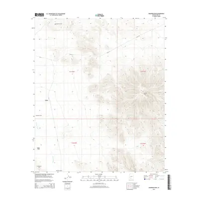
2014 Map of Cimarron Peak
USGS Topo · Published 2014About this map
Hickiwan Valley serves as the central geographic feature of this southwestern Arizona landscape, where high desert peaks descend into broad alluvial flats. The topography is dominated by the steep slopes of the Sauceda Mountains in the north and the prominent Cimarron Peak to the east. Modern infrastructure and indigenous settlements share the land, with Emika and Tatai Toak located near the ephemeral drainage of Hickiwan Wash. Transport through this arid corridor relies on several key routes, including the prominent Pipeline Rd and the Bureau of Indian Affairs road Bia-13. The map detail captures the intersection of traditional O'odham settlements and the functional utility corridors that cross the Sonoran desert floor, providing a clear view of the relationship between the rugged height of Roadrunner Mtn and the valley below.
Find a feature on this map
13 named features on this map. Tap any name to fly to it.
Don’t see what you’re looking for? This feature index may not catch every label — zoom into the map to look around manually.
Map Details
Editions of this 2014 Cimarron Peak Map
This is the sole edition of this map. No revisions or reprints were ever made.
Other maps of this area

1953 · Ajo
USGS Topo · 1:250,000

1957 · Ajo
USGS Topo · 1:250,000

1958 · Ajo
USGS Topo · 1:250,000

1958 · Kaka
USGS Topo · 1:62,500

1958 · Hat Mountain
USGS Topo · 1:62,500

1962 · Ajo
USGS Topo · 1:250,000

1963 · Ajo
USGS Topo · 1:250,000

1963 · Sikort Chuapo Mts
USGS Topo · 1:62,500

1963 · Cimarron Peak
USGS Topo · 1:62,500

1967 · Ajo
USGS Topo · 1:250,000