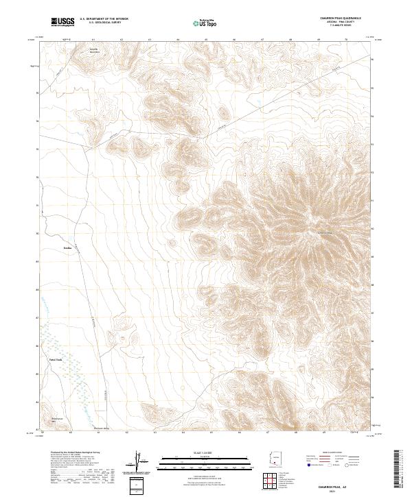
2021 Map of Cimarron Peak
USGS Topo · Published 2021About this map
Hickiwan Valley serves as a low-lying anchor for this corner of Pima County, where the seasonal waters of Hickiwan Wash trace the desert floor. The landscape is defined by the sharp verticality of the Sauceda Mountains in the northwest and the prominent rise of Cimarron Peak to the east. Sparse settlements such as Emika and Tatai Toak are situated along the lower elevations, connected by local routes including Indian Rte 13 and Stor Pitka Rd. The presence of Pipeline Rd cutting across the northern reaches indicates modern utility infrastructure traversing this arid terrain. This 2021 survey by the U.S. Geological Survey provides an intricate view of topographic relief, from the summit of Roadrunner Mtn to the alluvial patterns established by the region's washes.
Find a feature on this map
14 named features on this map. Tap any name to fly to it.
Don’t see what you’re looking for? This feature index may not catch every label — zoom into the map to look around manually.
Map Details
Editions of this 2021 Cimarron Peak Map
This is the sole edition of this map. No revisions or reprints were ever made.
Other maps of this area

1953 · Ajo
USGS Topo · 1:250,000

1957 · Ajo
USGS Topo · 1:250,000

1958 · Ajo
USGS Topo · 1:250,000

1958 · Kaka
USGS Topo · 1:62,500

1958 · Hat Mountain
USGS Topo · 1:62,500

1962 · Ajo
USGS Topo · 1:250,000

1963 · Ajo
USGS Topo · 1:250,000

1963 · Sikort Chuapo Mts
USGS Topo · 1:62,500

1963 · Cimarron Peak
USGS Topo · 1:62,500

1967 · Ajo
USGS Topo · 1:250,000