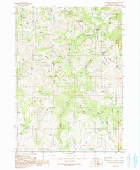
1990 Map of Cinnabar Mountain
USGS Topo · Published 1991About this map
The high ridges of the Silver City Range dominate this landscape, revealing a history of heavy exploration and extraction. A dense network of 4WD trails connects numerous mineral sites across the rugged terrain, including the Afterthought Mine and various unnamed adits, mine shafts, and prospects. These industrial footprints are particularly concentrated near Hayden Peak and Quicksilver Mountain, where tailings piles mark the drainage basins.
Find a feature on this map
45 named features on this map. Tap any name to fly to it.
Don’t see what you’re looking for? This feature index may not catch every label — zoom into the map to look around manually.
Map Details
Editions of this 1990 Cinnabar Mountain Map
This is the sole edition of this map. No revisions or reprints were ever made.
Other maps of this area

1892 · Silver City
USGS Topo · 1:125,000

1894 · Silver City
USGS Topo · 1:125,000

1898 · Silver City
USGS Topo · 1:125,000

1955 · Jordan Valley
USGS Topo · 1:250,000

1955 · Boise
USGS Topo · 1:250,000

1957 · Jordan Valley
USGS Topo · 1:250,000

1958 · Boise
USGS Topo · 1:250,000

1958 · Jordan Valley
USGS Topo · 1:250,000

1962 · Boise
USGS Topo · 1:250,000

1965 · Triangle
USGS Topo · 1:62,500