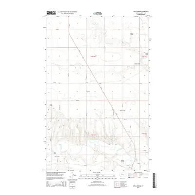
2014 Map of Circle Bridge
USGS Topo · Published 2014About this map
The Marias River carves a deep, winding course through the southern half of this Liberty County landscape, creating a complex series of breaks and coulees. These topographical features, including Basin Coulee, Dugout Coulee, and Wolfe Coulee, define the drainage patterns of the high plains north of the river. The area's settlement and infrastructure are deeply tied to these crossings, most notably at the Circle Bridge and the Moffat Bridge, which provide critical passage over the water.
Find a feature on this map
32 named features on this map. Tap any name to fly to it.
Don’t see what you’re looking for? This feature index may not catch every label — zoom into the map to look around manually.
Map Details
Editions of this 2014 Circle Bridge Map
This is the sole edition of this map. No revisions or reprints were ever made.
Other maps of this area

1954 · Shelby
USGS Topo · 1:250,000

1958 · Shelby
USGS Topo · 1:250,000

1970 · Circle Bridge
USGS Topo · 1:24,000

1970 · Poverty Coulee NE
USGS Topo · 1:24,000

1970 · Penzer School
USGS Topo · 1:24,000

1970 · Uphill Creek
USGS Topo · 1:24,000

1970 · Sagebrush Coulee
USGS Topo · 1:24,000

1970 · Poverty Coulee SE
USGS Topo · 1:24,000

1970 · Goose Bill Butte NW
USGS Topo · 1:24,000

1970 · Poverty Coulee
USGS Topo · 1:24,000