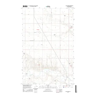
2017 Map of Circle Bridge
USGS Topo · Published 2017About this map
The Marias River carves a deep, winding path through the southern half of this landscape, creating a dramatic break in the high plains of Liberty County. This 2017 survey reveals a sparsely populated agricultural and ranching region defined by an extensive network of coulees that drain toward the river, including Layton Coulee, Sixmile Coulee, and Wolfe Coulee. Human presence is marked by the scattered infrastructure of the frontier, most notably at the Erickson Cem and the river crossings at Circle Bridge and Moffat Bridge. The terrain north of the river is etched with local roads such as Moffett Rd and Mountain Highway 366, illustrating how the township-and-range grid adapts to the natural drainage of Cottonwood Cr and other seasonal waterways.
Find a feature on this map
24 named features on this map. Tap any name to fly to it.
Don’t see what you’re looking for? This feature index may not catch every label — zoom into the map to look around manually.
Map Details
Editions of this 2017 Circle Bridge Map
This is the sole edition of this map. No revisions or reprints were ever made.
Other maps of this area

1954 · Shelby
USGS Topo · 1:250,000

1958 · Shelby
USGS Topo · 1:250,000

1970 · Circle Bridge
USGS Topo · 1:24,000

1970 · Poverty Coulee NE
USGS Topo · 1:24,000

1970 · Penzer School
USGS Topo · 1:24,000

1970 · Uphill Creek
USGS Topo · 1:24,000

1970 · Sagebrush Coulee
USGS Topo · 1:24,000

1970 · Poverty Coulee SE
USGS Topo · 1:24,000

1970 · Goose Bill Butte NW
USGS Topo · 1:24,000

1970 · Poverty Coulee
USGS Topo · 1:24,000