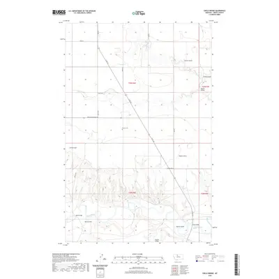
2020 Map of Circle Bridge
USGS Topo · Published 2020About this map
The Marias River carves a deep, winding course across the southern portion of this landscape, its steep bluffs creating a complex network of drainage ravines. Historical crossing points are marked by the Circle Bridge and Moffat Bridge, providing critical passage over the river in this section of Liberty County. The upland plains are characterized by an organized grid of section roads and large-scale agricultural infrastructure, including the Erickson Cem located near the center of the survey.
Find a feature on this map
26 named features on this map. Tap any name to fly to it.
Don’t see what you’re looking for? This feature index may not catch every label — zoom into the map to look around manually.
Map Details
Editions of this 2020 Circle Bridge Map
This is the sole edition of this map. No revisions or reprints were ever made.
Other maps of this area

1954 · Shelby
USGS Topo · 1:250,000

1958 · Shelby
USGS Topo · 1:250,000

1970 · Circle Bridge
USGS Topo · 1:24,000

1970 · Poverty Coulee NE
USGS Topo · 1:24,000

1970 · Penzer School
USGS Topo · 1:24,000

1970 · Uphill Creek
USGS Topo · 1:24,000

1970 · Sagebrush Coulee
USGS Topo · 1:24,000

1970 · Poverty Coulee SE
USGS Topo · 1:24,000

1970 · Goose Bill Butte NW
USGS Topo · 1:24,000

1970 · Poverty Coulee
USGS Topo · 1:24,000