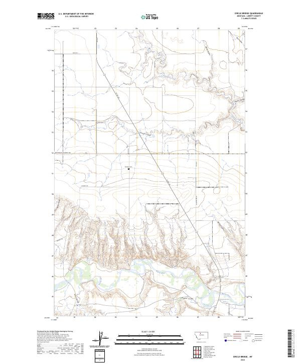
2024 Map of Circle Bridge
USGS Topo · Published 2024About this map
The Marias River carves a deep, winding path through the southern portion of this Liberty County landscape, creating a complex series of bluffs and breaks. The surrounding plains are heavily dissected by numerous drainage features, including Sixmile Coulee, Dugout Coulee, and Cottonwood Creek. Human presence is marked by a grid of rural roads and the secluded Erickson Cem, which stands as a quiet landmark amidst the vast open country. The intersection of Co RD 223 and Mountain Highway 366 serves as a primary transit corridor through these townships. Local family names and early settlement history are reflected in road and terrain labels such as Schumacher Ln, Wolfe Ave, and Wolfe Coulee, indicating the persistent legacy of ranching and farming families in this northern Montana region.
Find a feature on this map
24 named features on this map. Tap any name to fly to it.
Don’t see what you’re looking for? This feature index may not catch every label — zoom into the map to look around manually.
Map Details
Editions of this 2024 Circle Bridge Map
This is the sole edition of this map. No revisions or reprints were ever made.
Other maps of this area

1954 · Shelby
USGS Topo · 1:250,000

1958 · Shelby
USGS Topo · 1:250,000

1970 · Circle Bridge
USGS Topo · 1:24,000

1970 · Poverty Coulee NE
USGS Topo · 1:24,000

1970 · Penzer School
USGS Topo · 1:24,000

1970 · Uphill Creek
USGS Topo · 1:24,000

1970 · Sagebrush Coulee
USGS Topo · 1:24,000

1970 · Poverty Coulee SE
USGS Topo · 1:24,000

1970 · Goose Bill Butte NW
USGS Topo · 1:24,000

1970 · Poverty Coulee
USGS Topo · 1:24,000