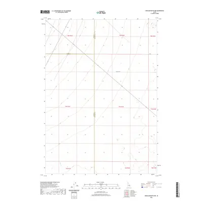
2020 Map of Circular Butte NW
USGS Topo · Published 2020About this map
Birch Cr winds through the southwestern corner of this landscape where the high desert of the Snake River Plain meets the northern mountain basins. This modern survey shows a largely open terrain defined by the complex convergence of three administrative boundaries: Clark, Butte, and Jefferson counties. The area is intersected by Wadsworth Rd, a long-distance track cutting diagonally across the high-elevation sections. The map provides a clear view of the Public Land Survey System (PLSS) grid, documenting townships T8N through T6N and ranges R31E through R33E, which remain the primary framework for land management and ranching navigation in this portion of Idaho.
Find a feature on this map
14 named features on this map. Tap any name to fly to it.
Don’t see what you’re looking for? This feature index may not catch every label — zoom into the map to look around manually.
Map Details
Editions of this 2020 Circular Butte NW Map
This is the sole edition of this map. No revisions or reprints were ever made.
Other maps of this area

1955 · Dubois
USGS Topo · 1:250,000

1955 · Idaho Falls
USGS Topo · 1:250,000

1958 · Dubois
USGS Topo · 1:250,000

1958 · Idaho Falls
USGS Topo · 1:250,000

1969 · Lidy Hot Springs SE
USGS Topo · 1:24,000

1969 · Antelope Butte
USGS Topo · 1:24,000

1969 · Circular Butte
USGS Topo · 1:24,000

1969 · Circular Butte NW
USGS Topo · 1:24,000

1969 · Richard Butte
USGS Topo · 1:24,000
1969 · Monteview
USGS Topo · 1:24,000