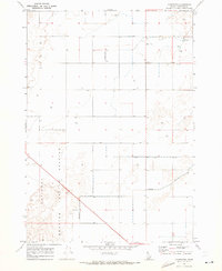
1969 Map of Monteview
USGS Topo · Published 1973About this map
National Reactor Testing Station lands occupy the southwestern quadrant of this high desert landscape, marking the intersection of advanced 20th-century technology and agricultural reclamation. In the late 1960s, the small community of Monteview serves as the focal point for local activity, surrounded by a grid of section lines and numerous irrigation wells. The reliance on subterranean water is evident through the many Well sites scattered across the terrain, supplemented by the North Lake Canal and Mc Kevitt Ditch which draw water through the arid plains. Transportation is represented by a small Landing Strip and a network of unimproved tracks and a Jeep Tr, indicating the sparse, utilitarian nature of the infrastructure during this period of Idaho's development.
Find a feature on this map
9 named features on this map. Tap any name to fly to it.
Don’t see what you’re looking for? This feature index may not catch every label — zoom into the map to look around manually.
Map Details
Editions of this 1969 Monteview Map
This is the sole edition of this map. No revisions or reprints were ever made.
Other maps of this area

1955 · Dubois
USGS Topo · 1:250,000

1955 · Idaho Falls
USGS Topo · 1:250,000

1958 · Dubois
USGS Topo · 1:250,000

1958 · Idaho Falls
USGS Topo · 1:250,000

1964 · Terreton
USGS Topo · 1:24,000

1964 · Cedar Butte SW
USGS Topo · 1:24,000

1964 · Mud Lake NW
USGS Topo · 1:24,000

1969 · Lidy Hot Springs SE
USGS Topo · 1:24,000

1969 · Antelope Butte
USGS Topo · 1:24,000

1969 · Circular Butte
USGS Topo · 1:24,000