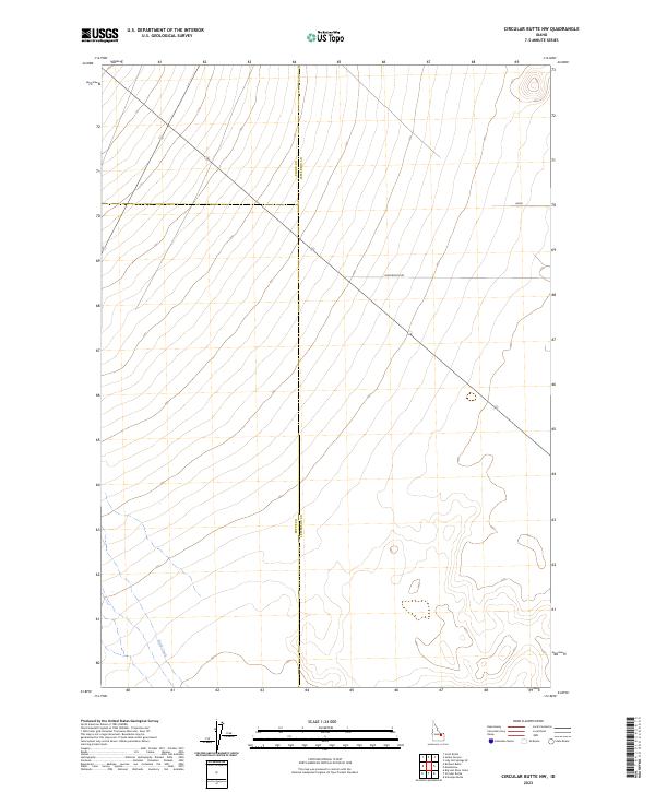
2023 Map of Circular Butte NW
USGS Topo · Published 2023About this map
Birch Creek flows through the southwestern corner of this high desert landscape, marking one of the few distinct natural water features in an area defined by its expansive topography. Located at the intersection of several county boundaries, the terrain is characterized by the convergence of Clark County and Jefferson County to the north and Butte County and Jefferson County to the west. A single thoroughfare, Wadsworth Rd, cuts diagonally across the northern sections, providing a critical transit link through the surveyed townships. The map illustrates the geometric precision of the Public Land Survey System, detailing the borders between townships including t7n r32e and t8n r32e, which organize this portion of the Snake River Plain.
Find a feature on this map
13 named features on this map. Tap any name to fly to it.
Don’t see what you’re looking for? This feature index may not catch every label — zoom into the map to look around manually.
Map Details
Editions of this 2023 Circular Butte NW Map
This is the sole edition of this map. No revisions or reprints were ever made.
Other maps of this area

1955 · Dubois
USGS Topo · 1:250,000

1955 · Idaho Falls
USGS Topo · 1:250,000

1958 · Dubois
USGS Topo · 1:250,000

1958 · Idaho Falls
USGS Topo · 1:250,000

1969 · Lidy Hot Springs SE
USGS Topo · 1:24,000

1969 · Antelope Butte
USGS Topo · 1:24,000

1969 · Circular Butte
USGS Topo · 1:24,000

1969 · Circular Butte NW
USGS Topo · 1:24,000

1969 · Richard Butte
USGS Topo · 1:24,000
1969 · Monteview
USGS Topo · 1:24,000