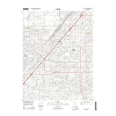
2015 Map of Citrus Heights
USGS Topo · Published 2015About this map
Citrus Heights and its neighboring communities are defined by a network of suburban expansion and historical burial grounds at the northern edge of the Central Valley. This survey documents the densely partitioned landscape between North Highlands and Fair Oaks, where significant institutions like American River Coll and Trinity Life Bible Coll sit alongside extensive memorial sites, including Calvary Cemetery and Sylvan Cemetery. The terrain is etched by several prominent drainage systems such as Arcade Cr and Chicken Ranch Slough, which flow westward toward the valley floor.
Find a feature on this map
42 named features on this map. Tap any name to fly to it.
Don’t see what you’re looking for? This feature index may not catch every label — zoom into the map to look around manually.
Map Details
Editions of this 2015 Citrus Heights Map
This is the sole edition of this map. No revisions or reprints were ever made.
Other maps of this area

1891 · Sacramento
USGS Topo · 1:125,000

1892 · Sacramento
USGS Topo · 1:125,000

1893 · Sacramento
USGS Topo · 1:125,000

1902 · Fairoaks
USGS Topo · 1:62,500

1908 · Buffalo Creek
USGS Topo · 1:31,680

1910 · Roseville
USGS Topo · 1:31,680

1910 · Pleasant Grove
USGS Topo · 1:31,680

1911 · Brighton
USGS Topo · 1:31,680

1911 · Mills
USGS Topo · 1:31,680

1911 · Arcade
USGS Topo · 1:31,680