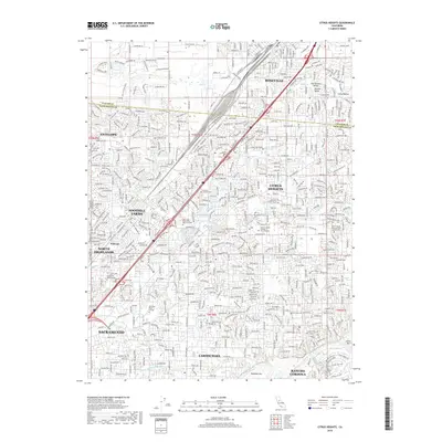
2018 Map of Citrus Heights
USGS Topo · Published 2018About this map
Sacramento and its northeastern suburbs are documented here during a period of dense residential expansion within the Sacramento Valley. The map details the suburban layout of Citrus Heights, Antelope, and North Highlands, showing the transition from the older city core toward the rising communities of Roseville and Carmichael. Along the southern edge, the American River provides a natural corridor featuring Rossmoor Bar and Sailor Bar. For local historians and genealogists, the map identifies several significant memorial sites, including Sylvan Cem, Fair Oaks Cem, and the expansive East Lawn Sierra Hills Memorial Park. The landscape is a network of developed streets interspersed with natural drainages like Dry Cr and Chicken Ranch Slough, reflecting the complex water management of the region.
Find a feature on this map
42 named features on this map. Tap any name to fly to it.
Don’t see what you’re looking for? This feature index may not catch every label — zoom into the map to look around manually.
Map Details
Editions of this 2018 Citrus Heights Map
This is the sole edition of this map. No revisions or reprints were ever made.
Other maps of this area

1891 · Sacramento
USGS Topo · 1:125,000

1892 · Sacramento
USGS Topo · 1:125,000

1893 · Sacramento
USGS Topo · 1:125,000

1902 · Fairoaks
USGS Topo · 1:62,500

1908 · Buffalo Creek
USGS Topo · 1:31,680

1910 · Roseville
USGS Topo · 1:31,680

1910 · Pleasant Grove
USGS Topo · 1:31,680

1911 · Brighton
USGS Topo · 1:31,680

1911 · Mills
USGS Topo · 1:31,680

1911 · Arcade
USGS Topo · 1:31,680