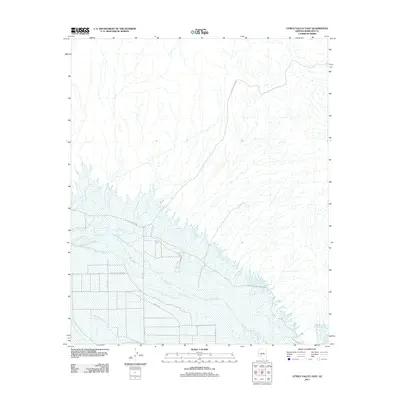
2011 Map of Citrus Valley East
USGS Topo · Published 2011About this map
The Gila River corridor defines this portion of the San Lucy District, where the desert landscape transitions into a managed agricultural and tribal infrastructure. The map reveals a structured grid of rural routes south of the river, including 371st Ave and 355th Ave, which support the local farming economy. Transportation through the arid terrain is facilitated by Indian Route Road 401 and Citrus Valley Rd, while the proximity to the Painted Rock Reservoir Rd indicates the area's role in regional water management. This 2011 survey captures the intersection of desert hydrography and deliberate land use, where the river's path is the central organizing force for the scattered settlements and roads of western Maricopa County.
Find a feature on this map
9 named features on this map. Tap any name to fly to it.
Don’t see what you’re looking for? This feature index may not catch every label — zoom into the map to look around manually.
Map Details
Editions of this 2011 Citrus Valley East Map
This is the sole edition of this map. No revisions or reprints were ever made.
Other maps of this area

1950 · Theba
USGS Topo · 1:62,500

1951 · Gila Bend
USGS Topo · 1:62,500

1951 · Theba
USGS Topo · 1:62,500

1951 · Cotton Center
USGS Topo · 1:62,500

1951 · Woolsey Peak
USGS Topo · 1:62,500

1953 · Ajo
USGS Topo · 1:250,000

1954 · Phoenix
USGS Topo · 1:250,000

1957 · Ajo
USGS Topo · 1:250,000

1957 · Phoenix
USGS Topo · 1:250,000

1958 · Ajo
USGS Topo · 1:250,000