
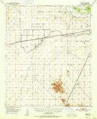
1951 Map of Theba
USGS Topo · Published 1951About this map
Gillespie Ranch and the small railroad siding of Theba define this desert landscape just south of the Gila River in the early 1950s. The region is a study in desert reclamation and transportation, where the Southern Pacific tracks run parallel to the Gila Bend Canal and a network of irrigation channels. Agriculture and aviation meet at the Gillespie Airfield and other private airstrips, which supported local ranching operations.
Find a feature on this map
25 named features on this map. Tap any name to fly to it.
Don’t see what you’re looking for? This feature index may not catch every label — zoom into the map to look around manually.
Map Details
Editions of this 1951 Theba Map
2 editions found
Other maps of this area

1942 · Vicksburg
USGS Topo · 1:250,000

1949 · Sentinel
USGS Topo · 1:62,500

1950 · Sentinel
USGS Topo · 1:62,500

1950 · Theba
USGS Topo · 1:62,500

1951 · Gila Bend
USGS Topo · 1:62,500

1951 · Dendora Valley
USGS Topo · 1:62,500

1951 · Cotton Center
USGS Topo · 1:62,500

1951 · Woolsey Peak
USGS Topo · 1:62,500

1953 · Ajo
USGS Topo · 1:250,000

1954 · Phoenix
USGS Topo · 1:250,000