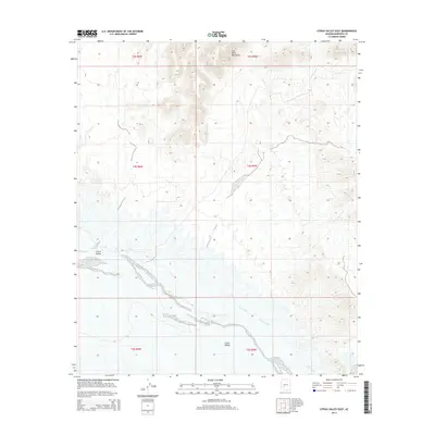
2014 Map of Citrus Valley East
USGS Topo · Published 2014About this map
Citrus Valley unfolds across this high-desert landscape in Maricopa County, dominated by the winding course of the Gila River. This 2014 survey captures the intricate relationship between the river and the surrounding arid terrain, where the Citrus Ditch serves as a vital artery for local irrigation. The northern reach of the map is defined by the steep, rocky slopes of the Gila Bend Mountains, which provide a stark vertical contrast to the broad alluvial plains below. The map documents a sparsely populated but geographically significant corridor, tracing the natural and engineered water systems that have shaped land use and desert settlement patterns in this part of Arizona. By detailing the township and range boundaries—including t4s r6w and t4s r5w—the survey provides a precise spatial framework for land ownership and historical property research in the San Lucy District.
Find a feature on this map
10 named features on this map. Tap any name to fly to it.
Don’t see what you’re looking for? This feature index may not catch every label — zoom into the map to look around manually.
Map Details
Editions of this 2014 Citrus Valley East Map
This is the sole edition of this map. No revisions or reprints were ever made.
Other maps of this area

1950 · Theba
USGS Topo · 1:62,500

1951 · Gila Bend
USGS Topo · 1:62,500

1951 · Theba
USGS Topo · 1:62,500

1951 · Cotton Center
USGS Topo · 1:62,500

1951 · Woolsey Peak
USGS Topo · 1:62,500

1953 · Ajo
USGS Topo · 1:250,000

1954 · Phoenix
USGS Topo · 1:250,000

1957 · Ajo
USGS Topo · 1:250,000

1957 · Phoenix
USGS Topo · 1:250,000

1958 · Ajo
USGS Topo · 1:250,000