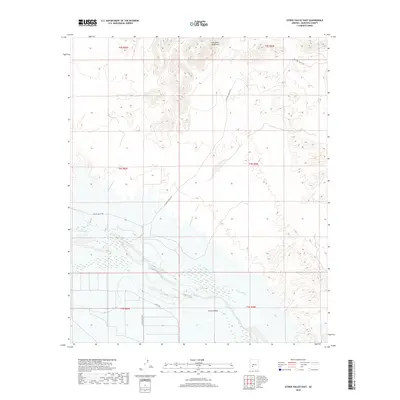
2018 Map of Citrus Valley East
USGS Topo · Published 2018About this map
Gila River flows through the southern portion of this desert landscape, its course flanked by the agricultural infrastructure of the Citrus Valley. This region, situated near the Gila Bend Mountains, showcases the critical relationship between water management and cultivation in the arid environment. The presence of the Citrus Ditch running parallel to the river suggests a sophisticated network for irrigation that sustains the valley's namesake industries. Local transit is defined by a grid of rural routes including Citrus Valley Rd and 355th Ave, which provide access to the parcelled lands. The map illustrates a transitional zone where the steep, topographic complexity of the northern ranges gives way to the structured, low-lying alluvial plains of the river valley.
Find a feature on this map
13 named features on this map. Tap any name to fly to it.
Don’t see what you’re looking for? This feature index may not catch every label — zoom into the map to look around manually.
Map Details
Editions of this 2018 Citrus Valley East Map
This is the sole edition of this map. No revisions or reprints were ever made.
Other maps of this area

1950 · Theba
USGS Topo · 1:62,500

1951 · Gila Bend
USGS Topo · 1:62,500

1951 · Theba
USGS Topo · 1:62,500

1951 · Cotton Center
USGS Topo · 1:62,500

1951 · Woolsey Peak
USGS Topo · 1:62,500

1953 · Ajo
USGS Topo · 1:250,000

1954 · Phoenix
USGS Topo · 1:250,000

1957 · Ajo
USGS Topo · 1:250,000

1957 · Phoenix
USGS Topo · 1:250,000

1958 · Ajo
USGS Topo · 1:250,000