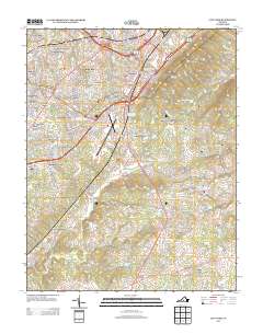
2013 Map of City Farm
USGS Topo · Published 2013About this map
City Farm and its surrounding Campbell County communities are documented here in a period of significant suburban development along the Us 29 and Us 460 corridors. The landscape is a mix of established residential subdivisions like Brookville, Sherwood Forest, and Heritage Hills set against the prominent elevations of Candler Mountain and Jack Mountain. The Lynchburg Regional Airport/Preston Glenn Field serves as a central infrastructure hub, anchoring the commercial and transportation activity of the region.
Find a feature on this map
64 named features on this map. Tap any name to fly to it.
Don’t see what you’re looking for? This feature index may not catch every label — zoom into the map to look around manually.
Map Details
Editions of this 2013 City Farm Map
This is the sole edition of this map. No revisions or reprints were ever made.
Other maps of this area

1892 · Lynchburg
USGS Topo · 1:125,000

1944 · Lynchburg
USGS Topo · 1:62,500

1947 · Roanoke
USGS Topo · 1:250,000

1950 · Goode
USGS Topo · 1:62,500

1950 · Lynchburg
USGS Topo · 1:62,500

1951 · Altavista
USGS Topo · 1:62,500

1956 · Gladys
USGS Topo · 1:62,500

1959 · Roanoke
USGS Topo · 1:250,000

1963 · Roanoke
USGS Topo · 1:250,000
1963 · Kelly
USGS Topo · 1:24,000