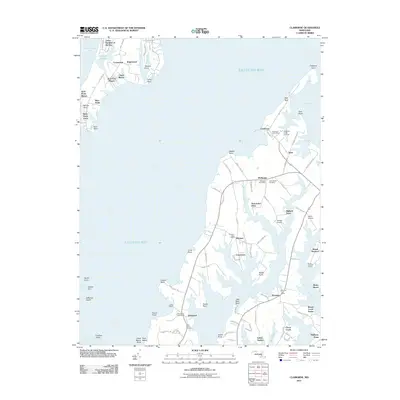
2011 Map of Claiborne
USGS Topo · Published 2011About this map
Eastern Bay and the fingers of the Chesapeake Bay define the landscape of this portion of Talbot County, where the intricate shoreline of the Maryland Eastern Shore is mapped in high detail. The map highlights the maritime-oriented settlement patterns of the early 21st century, from the clustered homes at Claiborne and McDaniel to the residential areas of Kent Point Manor and Tower Gardens of the Bay. These communities are tied to the water via historical access points like Lowes Wharf, Tilghman Creek Landing, and Mount Pleasant Landing.
Find a feature on this map
100 named features on this map. Tap any name to fly to it.
Don’t see what you’re looking for? This feature index may not catch every label — zoom into the map to look around manually.
Map Details
Editions of this 2011 Claiborne Map
This is the sole edition of this map. No revisions or reprints were ever made.
Other maps of this area

1892 · Annapolis
USGS Topo · 1:62,500

1893 · Sharps Island
USGS Topo · 1:62,500

1898 · Choptank
USGS Topo · 1:125,000

1904 · St. Michaels
USGS Topo · 1:62,500

1904 · Annapolis
USGS Topo · 1:62,500

1904 · Sharps Island
USGS Topo · 1:62,500

1904 · Oxford
USGS Topo · 1:62,500

1908 · Choptank
USGS Topo · 1:125,000

1942 · Tilghman
USGS Topo · 1:31,680

1942 · Oxford
USGS Topo · 1:31,680