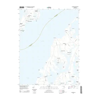
2014 Map of Claiborne
USGS Topo · Published 2014About this map
Chesapeake Bay divides the landscape where the southern tip of Kent Island meets the intricate western shoreline of Talbot County. The eastern shore is characterized by deep inlets and narrow necks, where settlements like Claiborne, McDaniel, and Wittman are situated among a network of tidal waters including Tilghman Creek and Cummings Creek. This modern survey illustrates a balance of residential development and agricultural preservation, with expansive properties such as Broad Creek Farms and Kent Fort Manor maintaining the coastal character of the region. Local heritage is preserved at sites like Saint James Cem near Sherwood and John Wesley Cem near the intersection of Sans Souci Dr. The geography of the inlets creates natural harbors like Indian Harbor and Ferry Cove, while small private airfields like Asplundh Airport serve the more modern logistical needs of the bayside communities.
Find a feature on this map
70 named features on this map. Tap any name to fly to it.
Don’t see what you’re looking for? This feature index may not catch every label — zoom into the map to look around manually.
Map Details
Editions of this 2014 Claiborne Map
This is the sole edition of this map. No revisions or reprints were ever made.
Other maps of this area

1892 · Annapolis
USGS Topo · 1:62,500

1893 · Sharps Island
USGS Topo · 1:62,500

1898 · Choptank
USGS Topo · 1:125,000

1904 · St. Michaels
USGS Topo · 1:62,500

1904 · Annapolis
USGS Topo · 1:62,500

1904 · Sharps Island
USGS Topo · 1:62,500

1904 · Oxford
USGS Topo · 1:62,500

1908 · Choptank
USGS Topo · 1:125,000

1942 · Tilghman
USGS Topo · 1:31,680

1942 · Oxford
USGS Topo · 1:31,680