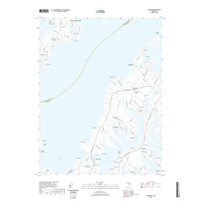
2019 Map of Claiborne
USGS Topo · Published 2019About this map
Eastern Bay dominates the center of this maritime landscape, separating the southern tip of Kent Island from the Claiborne peninsula. The map reveals the intricate shoreline of the Chesapeake, where land and water merge through a series of protected inlets and points. Along the western edge, Bloody Point and Kent Point overlook the Poplar Island Narrows, while to the east, the rural settlements of McDaniel and Sherwood are linked by Tilghman Island Road. Local heritage is anchored by sites such as the John Wesley Methodist Church Cem and Saint James Cem, providing valuable touchpoints for genealogical research. The region's connection to aviation and coastal travel is evident in the presence of Kent Fort Manor Airport and Asplundh Airport, alongside numerous family-named coves like Leadenham Creek and Grace Creek that define the local geography.
Find a feature on this map
112 named features on this map. Tap any name to fly to it.
Don’t see what you’re looking for? This feature index may not catch every label — zoom into the map to look around manually.
Map Details
Editions of this 2019 Claiborne Map
This is the sole edition of this map. No revisions or reprints were ever made.
Other maps of this area

1892 · Annapolis
USGS Topo · 1:62,500

1893 · Sharps Island
USGS Topo · 1:62,500

1898 · Choptank
USGS Topo · 1:125,000

1904 · St. Michaels
USGS Topo · 1:62,500

1904 · Annapolis
USGS Topo · 1:62,500

1904 · Sharps Island
USGS Topo · 1:62,500

1904 · Oxford
USGS Topo · 1:62,500

1908 · Choptank
USGS Topo · 1:125,000

1942 · Tilghman
USGS Topo · 1:31,680

1942 · Oxford
USGS Topo · 1:31,680