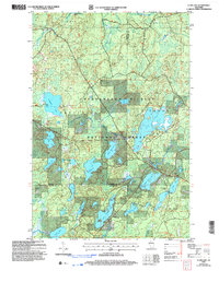
2022 Map of Clam Lake
USGS Topo · Published 2022About this map
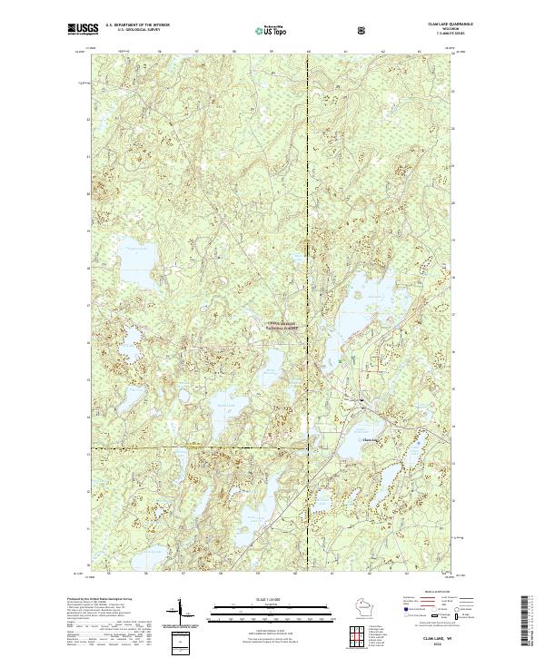
The settlement of Clam Lake sits at the nexus of several water systems in northern Wisconsin, situated where Upper Clam Lake meets the West Fork Chippewa River. The landscape is dominated by the Chequamegon National Forest, which encompasses a dense network of glacial lakes including Chippewa Lake, White Bass Lake, and Buffalo Lake. This 2022 survey details the modern recreational infrastructure of the area, featuring the Day Lake Trl and the Clam Lake Connector Trl winding through the timberland. Genealogical and local history points of interest include the Clam Lake Cem located near the town center. The map also delineates the complex county boundaries where Bayfield, Sawyer, and Ashland counties converge, reflecting the jurisdictional layout of this woodland region.
Find a feature on this map
47 named features on this map. Tap any name to fly to it.
Don’t see what you’re looking for? This feature index may not catch every label — zoom into the map to look around manually.
Map Details
Editions of this 2022 Clam Lake Map
This is the sole edition of this map. No revisions or reprints were ever made.
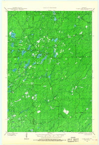
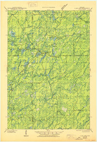
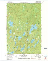
Historical Maps of Marengo Through Time
5 maps found