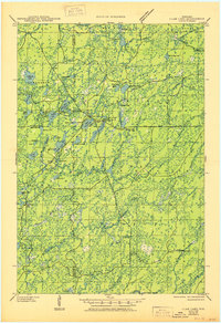
1945 Map of Clam Lake
USGS Topo · Published 1950About this map
Chequamegon National Forest dominates this mid-century survey, revealing a landscape defined by New Deal-era infrastructure and glacial hydrology. The small settlement of Clam Lake serves as a central hub, surrounded by institutional landmarks like the Clam Lake CCC Camp, the NYA Camp, and the Clam Lake Guard Station. These sites reflect the organized forestry and youth labor programs that shaped the region during the 1930s and early 1940s.
Find a feature on this map
49 named features on this map. Tap any name to fly to it.
Don’t see what you’re looking for? This feature index may not catch every label — zoom into the map to look around manually.
Map Details
Editions of this 1945 Clam Lake Map
2 editions found

Other maps of this area

1941 · Kennedy
USGS Topo · 1:48,000

1942 · Glidden
USGS Topo · 1:48,000

1942 · Clam Lake
USGS Topo · 1:48,000

1942 · Mellen
USGS Topo · 1:48,000

1942 · Marengo
USGS Topo · 1:48,000

1943 · Namekagon Lake
USGS Topo · 1:48,000

1944 · Draper
USGS Topo · 1:48,000

1944 · Radisson
USGS Topo · 1:48,000

1944 · Grandview
USGS Topo · 1:48,000

1945 · Kennedy
USGS Topo · 1:48,000