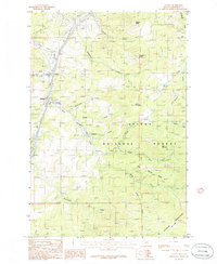
1985 Map of Clancy
USGS Topo · Published 1986About this map
Clancy and Alhambra serve as the primary focal points of this mid-1980s survey, situated along the corridor of Prickly Pear Creek. The map documents a landscape defined by its extractive history, with numerous Mine Shafts, Prospects, and an Adit scattered across the eastern slopes of the Elkhorn Mountains. The transition from valley settlement to the protected timberlands of the Helena National Forest is clear, as the terrain rises toward peaks like Lava Mountain and Burnt Mountain. Notable for genealogists and local historians is the site of Alhambra Hot Springs and the path of an Abandoned RR that once followed the gulches. The drainage network is intricately mapped, featuring the confluences of Lump Gulch, Strawberry Creek, and Warm Springs Creek, while isolated points of interest like a Lookout Tower on Strawberry Butte provide markers for the era's forest management practices.
Find a feature on this map
36 named features on this map. Tap any name to fly to it.
Don’t see what you’re looking for? This feature index may not catch every label — zoom into the map to look around manually.
Map Details
Editions of this 1985 Clancy Map
This is the sole edition of this map. No revisions or reprints were ever made.
Other maps of this area

1886 · Fort Logan
USGS Topo · 1:250,000

1889 · Helena
USGS Topo · 1:250,000

1893 · Helena
USGS Topo · 1:250,000

1899 · Boulder
USGS Topo · 1:125,000

1899 · Helena
USGS Topo · 1:62,500

1899 · Helena
USGS Topo · 1:250,000

1903 · Helena
USGS Topo · 1:250,000

1947 · Butte
USGS Topo · 1:250,000

1948 · White Sulphur Springs
USGS Topo · 1:250,000

1950 · Jefferson City
USGS Topo · 1:62,500