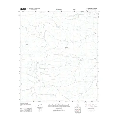
2012 Map of Clanton Draw
USGS Topo · Published 2012About this map
Upshaw Ranch and other family holdings define the ranching landscape of Hidalgo County in this 2012 topographic study. The drainage patterns of the Peloncillo Mountains are clearly marked by features such as Clanton Draw, Bercham Draw, and the seasonal flows of Walnut Cr. This arid corner of New Mexico reveals a network of primitive roads and historical routes, most notably the Geronimo Trl, which cuts across the southern portion of the quadrangle. Smaller cattle operations like Gowan Ranch and Field Ranch are positioned near these watercourses and canyon passes, including Dutchman Canyon and Whitmire Canyon, illustrating the essential connection between geography and livestock management in the high desert.
Find a feature on this map
16 named features on this map. Tap any name to fly to it.
Don’t see what you’re looking for? This feature index may not catch every label — zoom into the map to look around manually.
Map Details
Editions of this 2012 Clanton Draw Map
This is the sole edition of this map. No revisions or reprints were ever made.
Other maps of this area

1917 · Chiricahua
USGS Topo · 1:125,000

1918 · Cienega Springs
USGS Topo · 1:62,500

1918 · Animas Peak
USGS Topo · 1:62,500

1919 · Perilla
USGS Topo · 1:125,000

1919 · Chiricahua
USGS Topo · 1:125,000

1920 · Animas Peak
USGS Topo · 1:62,500

1922 · McDonald
USGS Topo · 1:62,500

1940 · Apache
USGS Topo · 1:62,500

1955 · Douglas
USGS Topo · 1:250,000

1958 · Apache
USGS Topo · 1:62,500