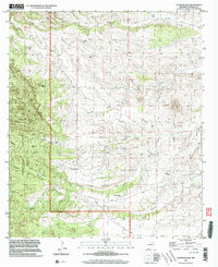
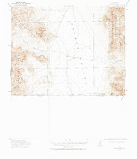
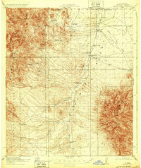
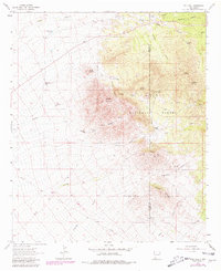
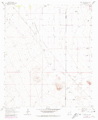
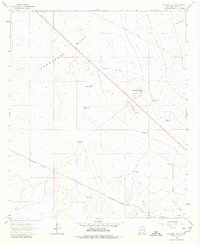
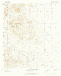
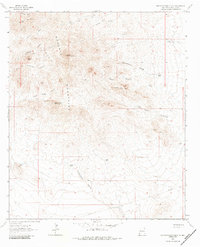
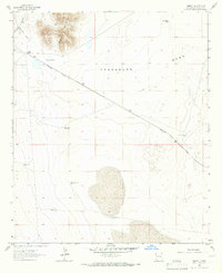
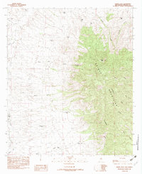
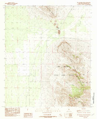
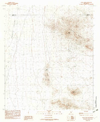
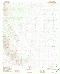
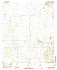
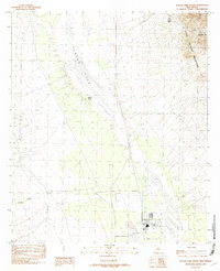
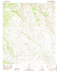
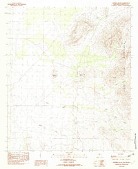
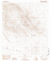
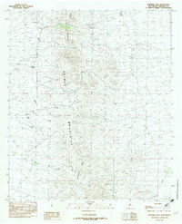
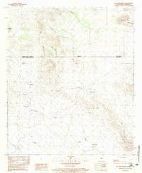
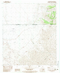
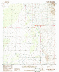
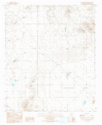
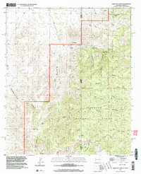
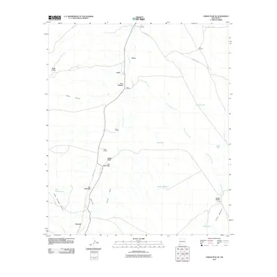
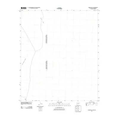
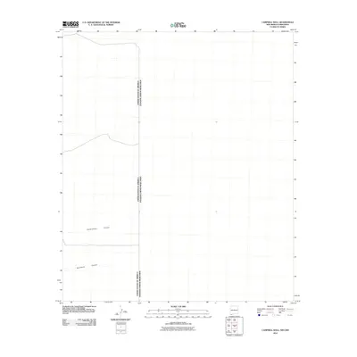
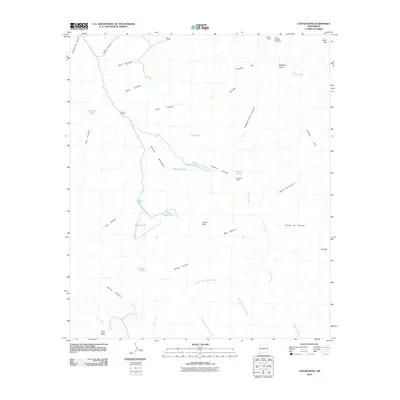
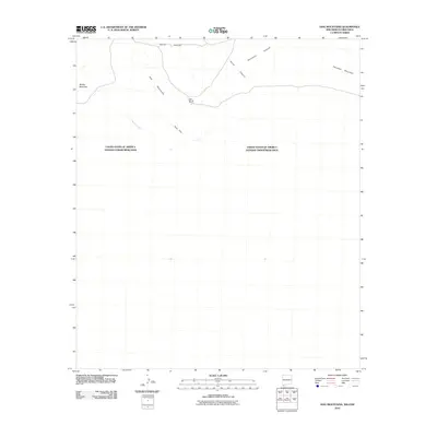
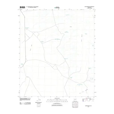
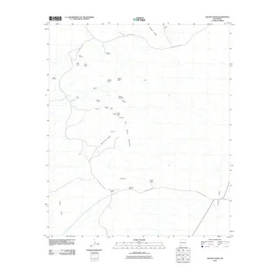
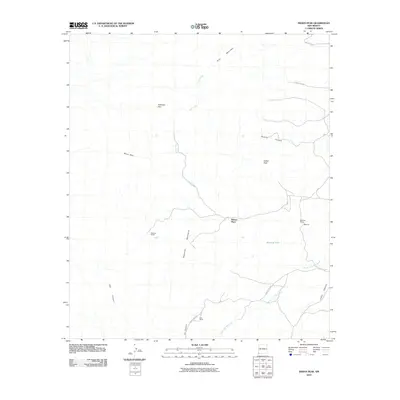
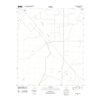
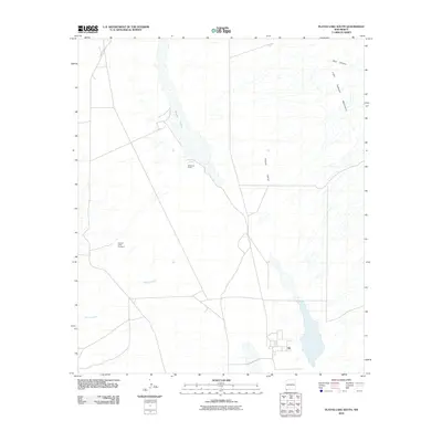
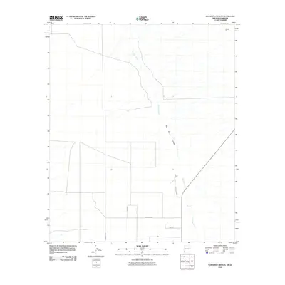
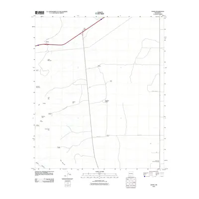
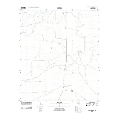
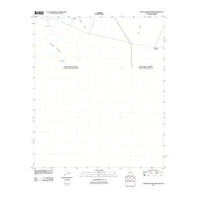
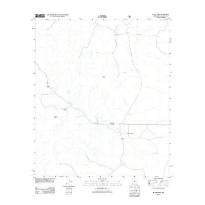
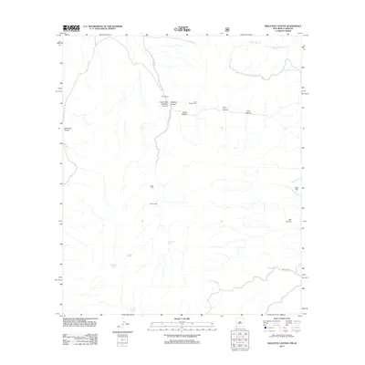
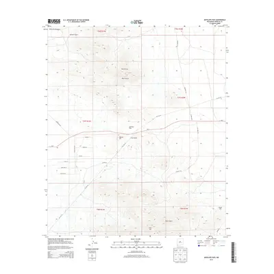
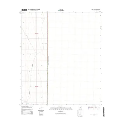
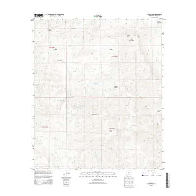
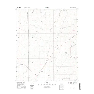
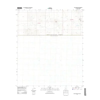
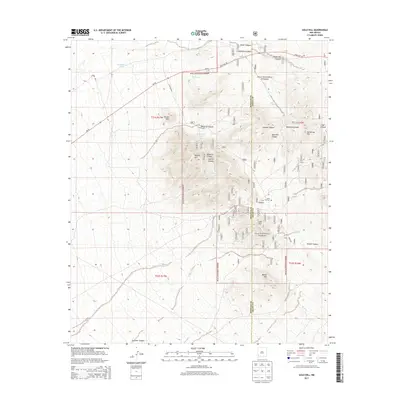
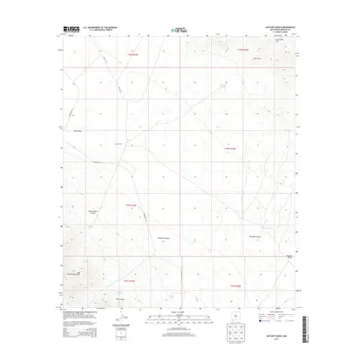
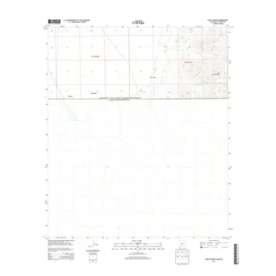
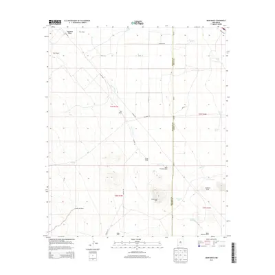
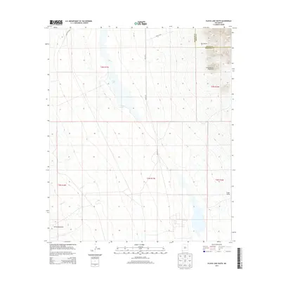
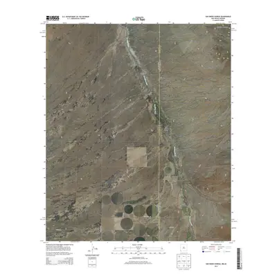
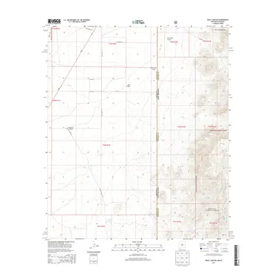
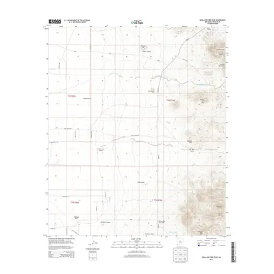
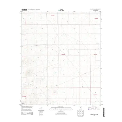
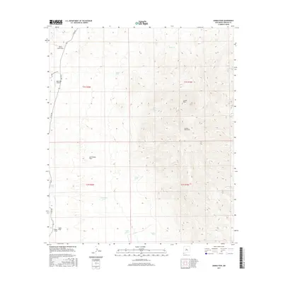
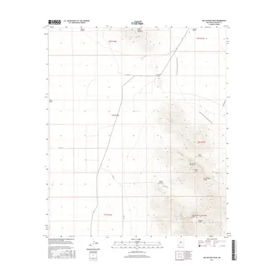
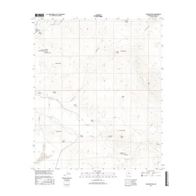
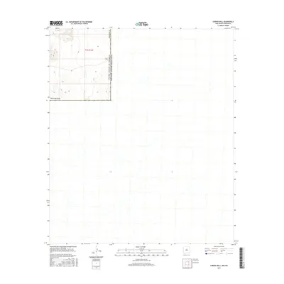
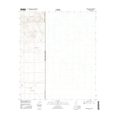
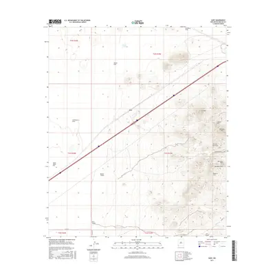
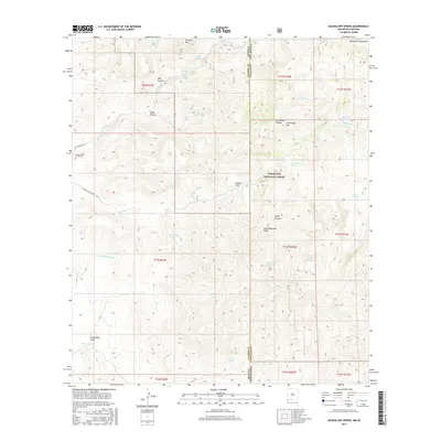
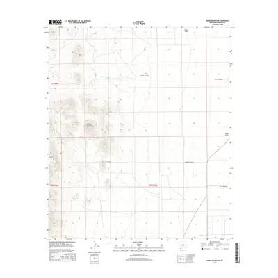
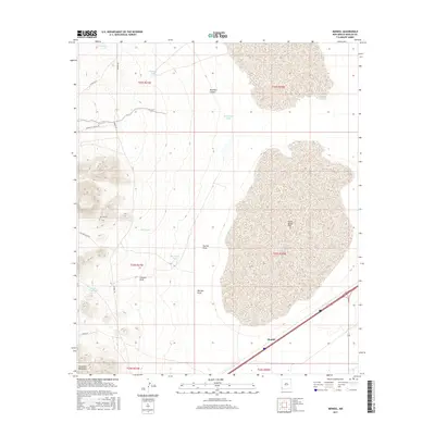
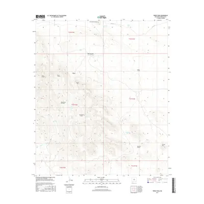
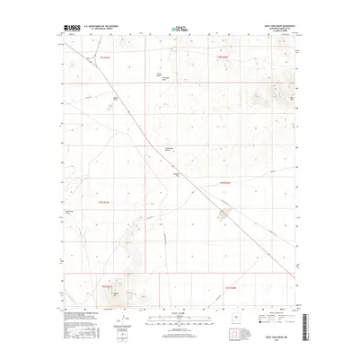
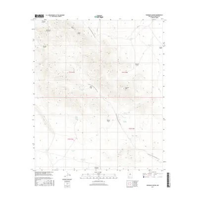
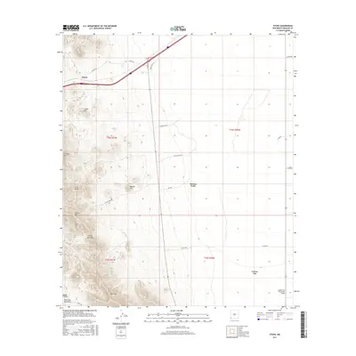
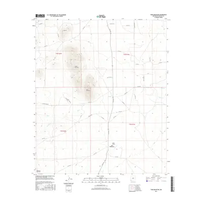
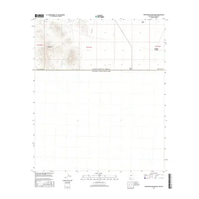
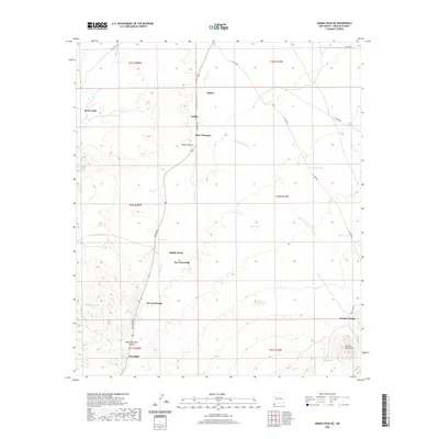
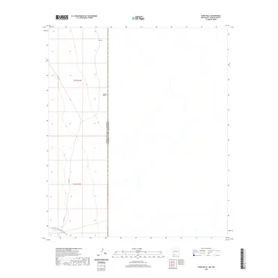
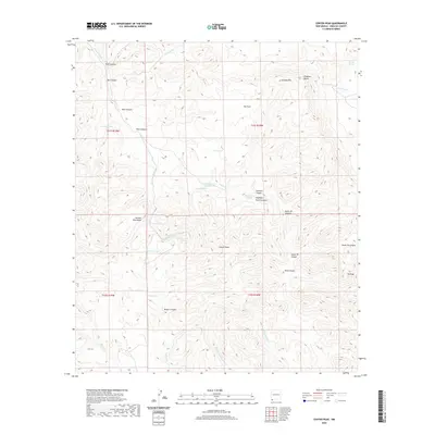
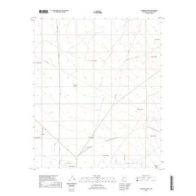
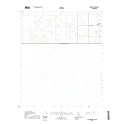
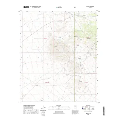
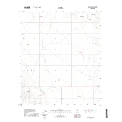
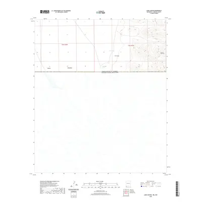
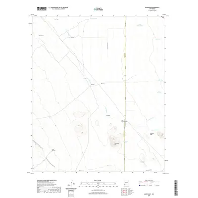
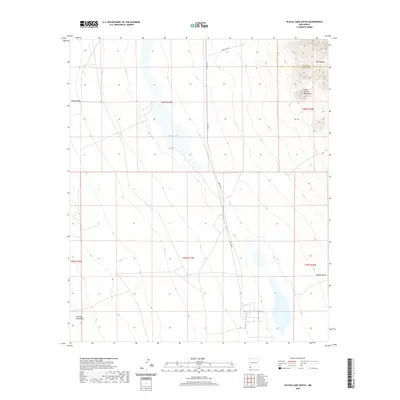
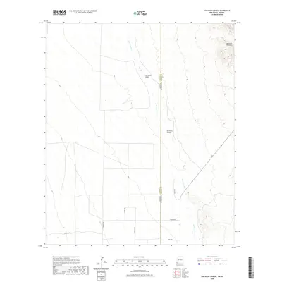
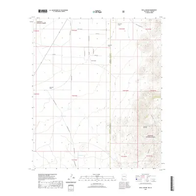
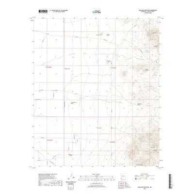
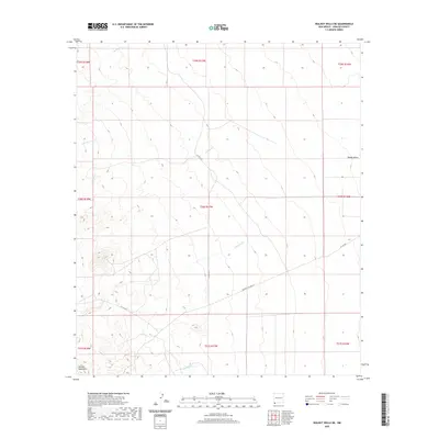
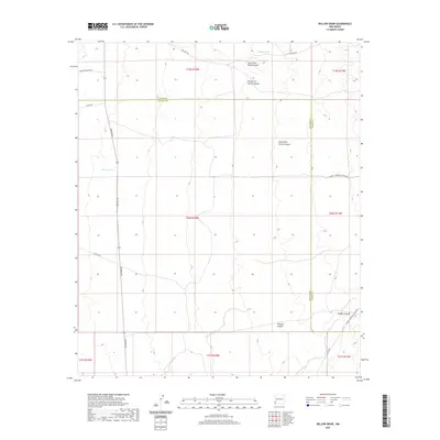
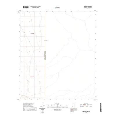
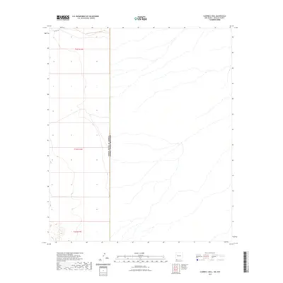
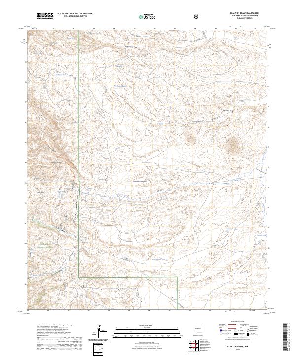
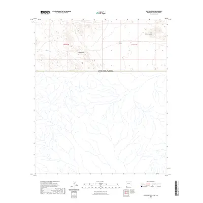
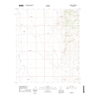
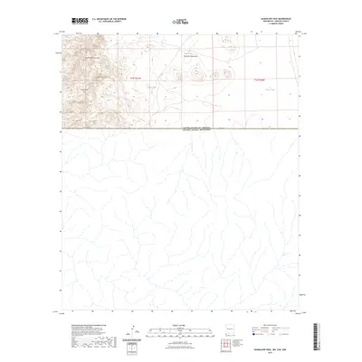
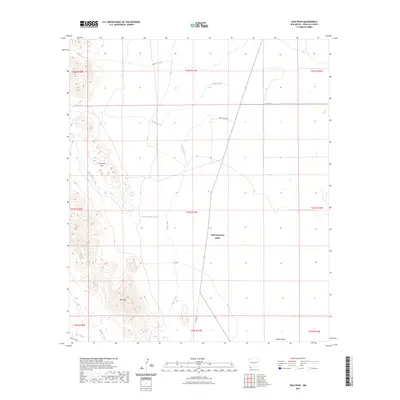
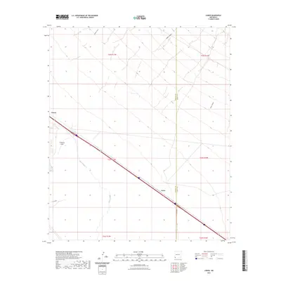
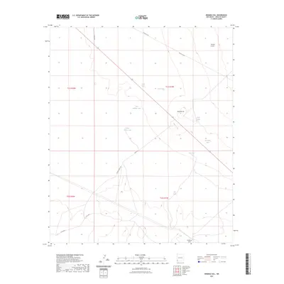
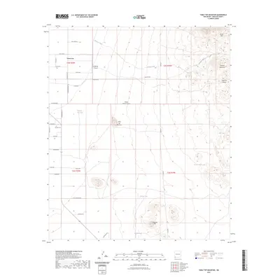
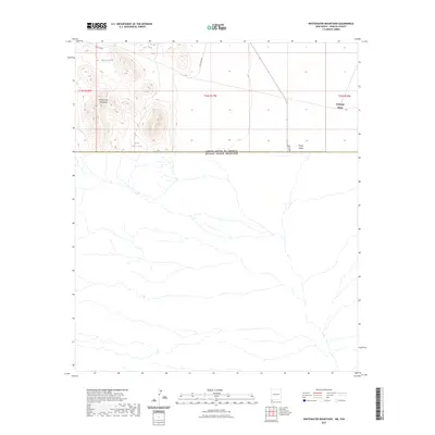
1998 Map of Clanton Draw
USGS Topo · Published 2003About this map
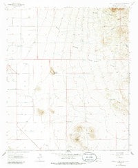
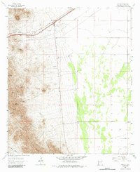
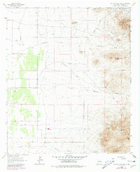
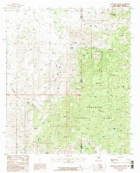
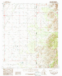
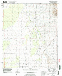
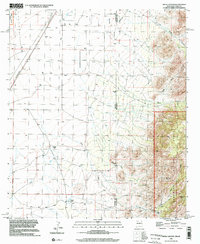
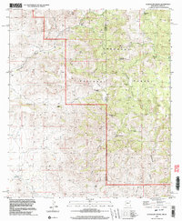
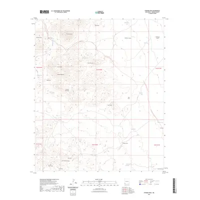
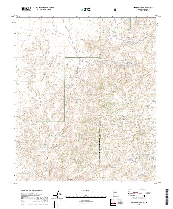
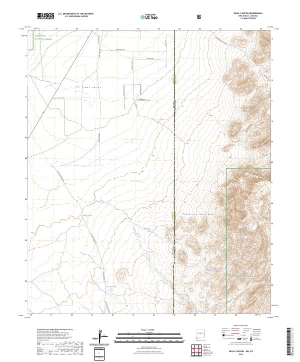
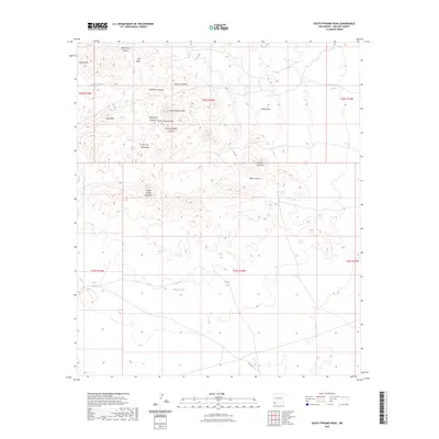
Coronado National Forest dominates the western portion of this landscape, where steep drainages like Skeleton Canyon and Dutchman Canyon carve into the high ground. This arid region of Hidalgo County relies on an extensive network of water catchments, as evidenced by the numerous named tanks such as Maddock Tank, Irishman Tank, and Cowan Tank. These features reflect a ranching and land management economy designed to capture seasonal runoff in a dry environment.
Find a feature on this map
28 named features on this map. Tap any name to fly to it.
Don’t see what you’re looking for? This feature index may not catch every label — zoom into the map to look around manually.
Map Details
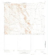
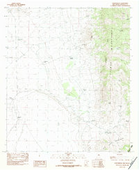
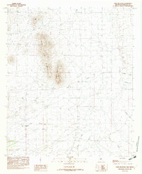
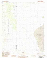
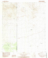
Editions of this 1998 Clanton Draw Map
This is the sole edition of this map. No revisions or reprints were ever made.
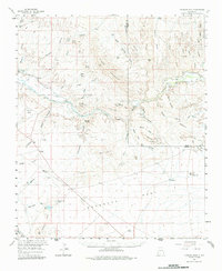
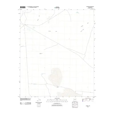
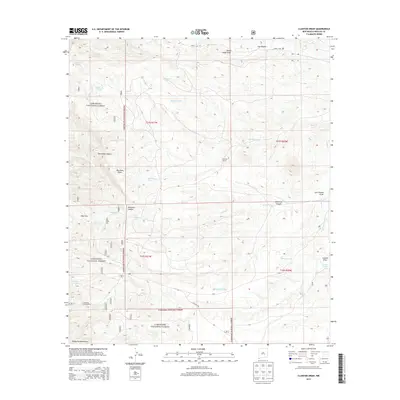
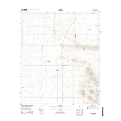
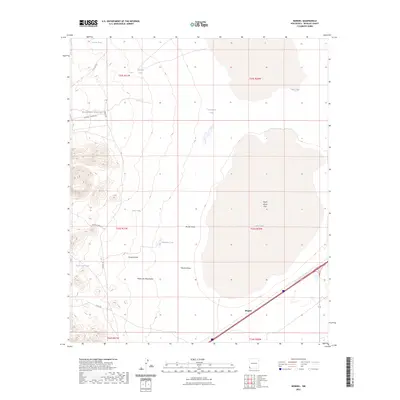
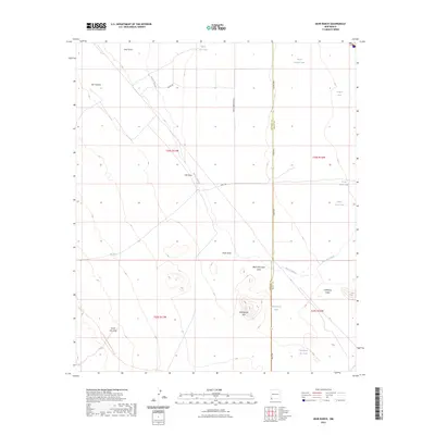
Historical Maps of Hidalgo County Through Time
375 maps found
1917 Antelope Wells
Hidalgo County, NM
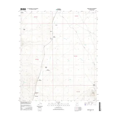
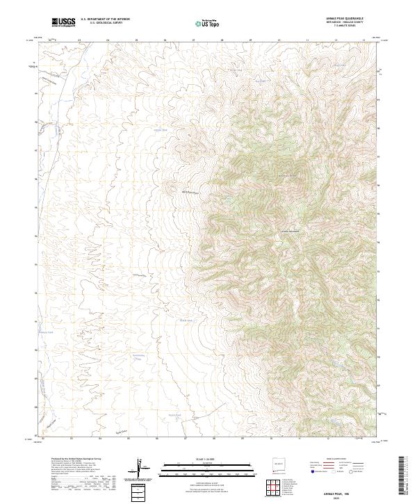
1918 Animas Peak
Hidalgo County, NM
1918 Big Hatchet Peak
Hidalgo County, NM
1918 Cienega Springs
Hidalgo County, NM
1918 Dog Mountains
Hidalgo County, NM

1918 Pratt
Hidalgo County, NM
1918 Walnut Wells
Hidalgo County, NM
1919 Antelope Wells
Hidalgo County, NM

1919 Pratt
Hidalgo County, NM
1920 Animas Peak
Hidalgo County, NM

1923 Walnut Wells
Hidalgo County, NM
1959 Canador Peak
Hidalgo County, NM
1962 Lisbon
Hidalgo County, NM
1963 Culberson Ranch
Hidalgo County, NM
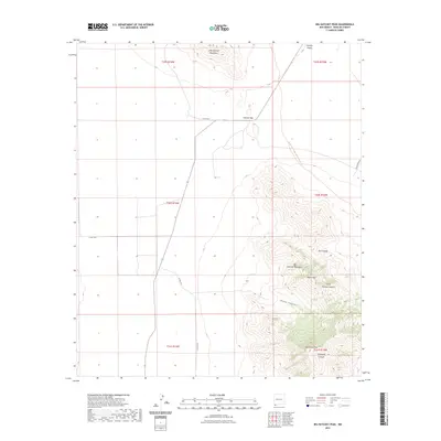
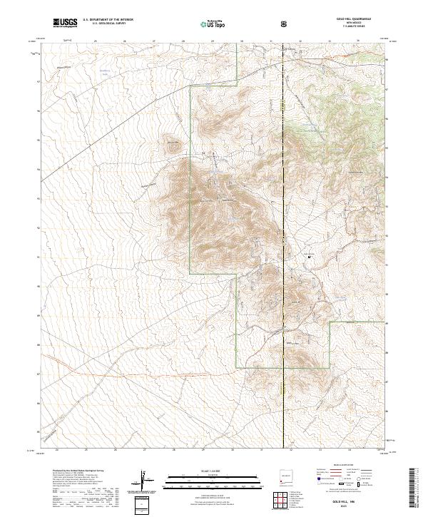
1963 Gold Hill
Hidalgo County, NM
1964 Coyote Peak
Hidalgo County, NM
1964 Gary
Hidalgo County, NM
1964 Mondel
Hidalgo County, NM
1964 Muir Ranch
Hidalgo County, NM
1964 Ninemile Hill
Hidalgo County, NM
1964 Pyramid Peak
Hidalgo County, NM
1964 South Pyramid Peak
Hidalgo County, NM
1964 Summit
Hidalgo County, NM
1964 Table Top Mountain
Hidalgo County, NM
1965 Steins
Hidalgo County, NM
1965 Swallow Fork Peak
Hidalgo County, NM
1982 Animas Peak
Hidalgo County, NM
1982 Animas Peak NE
Hidalgo County, NM
1982 Antelope Pass
Hidalgo County, NM
1982 Beacon Hill
Hidalgo County, NM
1982 Big Hatchet Peak
Hidalgo County, NM
1982 Black Point
Hidalgo County, NM
1982 Center Peak
Hidalgo County, NM
1982 Clanton Draw
Hidalgo County, NM
1982 Doyle Peak
Hidalgo County, NM
1982 Fitzpatricks
Hidalgo County, NM

1982 Gillespie Mountain
Hidalgo County, NM
1982 Hachita Peak
Hidalgo County, NM
1982 Hatchet Ranch
Hidalgo County, NM
1982 Hilo Peak
Hidalgo County, NM
1982 Horse Mountain
Hidalgo County, NM
1982 Indian Peak
Hidalgo County, NM

1982 Mount Baldy
Hidalgo County, NM
1982 Pierce Peak
Hidalgo County, NM
1982 Playas Lake North
Hidalgo County, NM
1982 Playas Lake South
Hidalgo County, NM
1982 San Luis Pass
Hidalgo County, NM
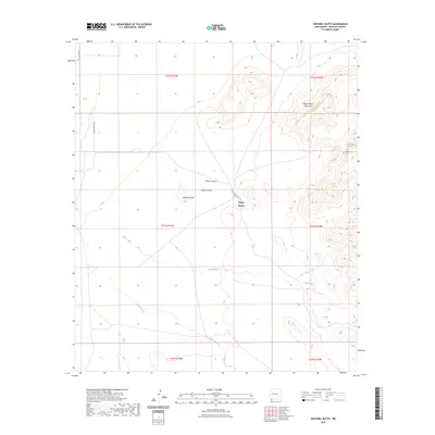
1982 Sentinel Butte
Hidalgo County, NM
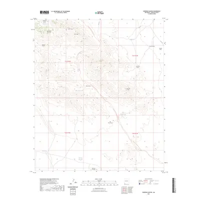
1982 Sheridan Canyon
Hidalgo County, NM
1982 Tank Mountain
Hidalgo County, NM
1982 U Bar Ridge
Hidalgo County, NM
1982 Walnut Wells NE
Hidalgo County, NM
1982 Whitmire Pass
Hidalgo County, NM

1983 Alamo Hueco Mountains
Hidalgo County, NM
1983 Cabin Wells
Hidalgo County, NM
1983 Campbell Well
Hidalgo County, NM
1983 Corner Well
Hidalgo County, NM
1983 Dog Mountains
Hidalgo County, NM
1983 Double Wells
Hidalgo County, NM
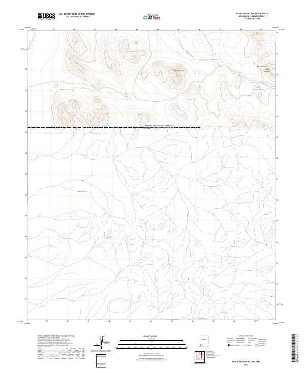
1983 Eagle Mountain
Hidalgo County, NM
1983 Guadalupe Pass
Hidalgo County, NM
1983 Lang Canyon
Hidalgo County, NM
1983 Whitewater Creek
Hidalgo County, NM
1983 Whitewater Mountains
Hidalgo County, NM
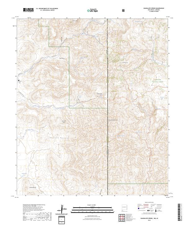
1985 Guadalupe Spring
Hidalgo County, NM
1987 San Simon Cienega
Hidalgo County, NM
1987 Skeleton Canyon
Hidalgo County, NM
1987 Skull Canyon
Hidalgo County, NM

1990 Canador Peak
Hidalgo County, NM
1990 Caprock Mountain
Hidalgo County, NM
1990 Rock Tank Draw
Hidalgo County, NM

1990 Willow Draw
Hidalgo County, NM
1996 San Simon Cienega
Hidalgo County, NM
1996 Skull Canyon
Hidalgo County, NM
1997 Guadalupe Spring
Hidalgo County, NM

1997 Mount Baldy
Hidalgo County, NM
1997 Skeleton Canyon
Hidalgo County, NM
1998 Black Point
Hidalgo County, NM
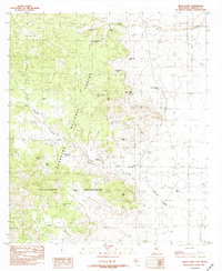
1998 Clanton Draw
Hidalgo County, NM
1999 Gold Hill
Hidalgo County, NM
2010 Animas Peak
Hidalgo County, NM
2010 Animas Peak NE
Hidalgo County, NM
2010 Antelope Pass
Hidalgo County, NM
2010 Beacon Hill
Hidalgo County, NM
2010 Big Hatchet Peak
Hidalgo County, NM
2010 Cabin Wells
Hidalgo County, NM
2010 Campbell Well
Hidalgo County, NM
2010 Canador Peak
Hidalgo County, NM
2010 Caprock Mountain
Hidalgo County, NM
2010 Center Peak
Hidalgo County, NM
2010 Corner Well
Hidalgo County, NM
2010 Coyote Peak
Hidalgo County, NM
2010 Culberson Ranch
Hidalgo County, NM
2010 Dog Mountains
Hidalgo County, NM
2010 Double Wells
Hidalgo County, NM
2010 Doyle Peak
Hidalgo County, NM
2010 Eagle Mountain
Hidalgo County, NM
2010 Fitzpatricks
Hidalgo County, NM
2010 Gary
Hidalgo County, NM
2010 Gillespie Mountain
Hidalgo County, NM
2010 Guadalupe Pass
Hidalgo County, NM
2010 Hachita Peak
Hidalgo County, NM
2010 Hatchet Ranch
Hidalgo County, NM
2010 Hilo Peak
Hidalgo County, NM
2010 Horse Mountain
Hidalgo County, NM
2010 Indian Peak
Hidalgo County, NM
2010 Lang Canyon
Hidalgo County, NM
2010 Lisbon
Hidalgo County, NM
2010 Mondel
Hidalgo County, NM
2010 Muir Ranch
Hidalgo County, NM
2010 Ninemile Hill
Hidalgo County, NM
2010 Pierce Peak
Hidalgo County, NM
2010 Playas Lake North
Hidalgo County, NM
2010 Playas Lake South
Hidalgo County, NM
2010 Pyramid Peak
Hidalgo County, NM
2010 Rock Tank Draw
Hidalgo County, NM
2010 San Luis Pass
Hidalgo County, NM
2010 San Simon Cienega
Hidalgo County, NM
2010 Sentinel Butte
Hidalgo County, NM
2010 Sheridan Canyon
Hidalgo County, NM
2010 South Pyramid Peak
Hidalgo County, NM
2010 Steins
Hidalgo County, NM
2010 Summit
Hidalgo County, NM
2010 Swallow Fork Peak
Hidalgo County, NM
2010 Table Top Mountain
Hidalgo County, NM
2010 Tank Mountain
Hidalgo County, NM
2010 U Bar Ridge
Hidalgo County, NM
2010 Walnut Wells NE
Hidalgo County, NM
2010 Whitewater Creek
Hidalgo County, NM
2010 Whitewater Mountains
Hidalgo County, NM
2010 Whitmire Pass
Hidalgo County, NM
2010 Willow Draw
Hidalgo County, NM
2011 Gold Hill
Hidalgo County, NM
2012 Black Point
Hidalgo County, NM
2012 Clanton Draw
Hidalgo County, NM
2012 Guadalupe Spring
Hidalgo County, NM
2012 Mount Baldy
Hidalgo County, NM
2012 Skeleton Canyon
Hidalgo County, NM
2012 Skull Canyon
Hidalgo County, NM
2013 Animas Peak
Hidalgo County, NM
2013 Animas Peak NE
Hidalgo County, NM
2013 Antelope Pass
Hidalgo County, NM
2013 Beacon Hill
Hidalgo County, NM
2013 Big Hatchet Peak
Hidalgo County, NM
2013 Black Point
Hidalgo County, NM
2013 Cabin Wells
Hidalgo County, NM
2013 Campbell Well
Hidalgo County, NM
2013 Canador Peak
Hidalgo County, NM
2013 Caprock Mountain
Hidalgo County, NM
2013 Center Peak
Hidalgo County, NM
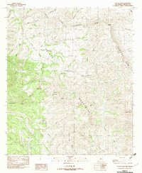
2013 Clanton Draw
Hidalgo County, NM
2013 Corner Well
Hidalgo County, NM
2013 Coyote Peak
Hidalgo County, NM
2013 Culberson Ranch
Hidalgo County, NM
2013 Dog Mountains
Hidalgo County, NM
2013 Double Wells
Hidalgo County, NM
2013 Doyle Peak
Hidalgo County, NM
2013 Eagle Mountain
Hidalgo County, NM
2013 Fitzpatricks
Hidalgo County, NM
2013 Gary
Hidalgo County, NM
2013 Gillespie Mountain
Hidalgo County, NM
2013 Gold Hill
Hidalgo County, NM
2013 Guadalupe Pass
Hidalgo County, NM
2013 Guadalupe Spring
Hidalgo County, NM
2013 Hachita Peak
Hidalgo County, NM
2013 Hatchet Ranch
Hidalgo County, NM
2013 Hilo Peak
Hidalgo County, NM
2013 Horse Mountain
Hidalgo County, NM
2013 Indian Peak
Hidalgo County, NM
2013 Lang Canyon
Hidalgo County, NM
2013 Lisbon
Hidalgo County, NM
2013 Mondel
Hidalgo County, NM
2013 Mount Baldy
Hidalgo County, NM
2013 Muir Ranch
Hidalgo County, NM
2013 Ninemile Hill
Hidalgo County, NM
2013 Pierce Peak
Hidalgo County, NM
2013 Playas Lake North
Hidalgo County, NM
2013 Playas Lake South
Hidalgo County, NM
2013 Pyramid Peak
Hidalgo County, NM
2013 Rock Tank Draw
Hidalgo County, NM
2013 San Luis Pass
Hidalgo County, NM
2013 San Simon Cienega
Hidalgo County, NM
2013 Sentinel Butte
Hidalgo County, NM
2013 Sheridan Canyon
Hidalgo County, NM
2013 Skeleton Canyon
Hidalgo County, NM
2013 Skull Canyon
Hidalgo County, NM
2013 South Pyramid Peak
Hidalgo County, NM
2013 Steins
Hidalgo County, NM
2013 Summit
Hidalgo County, NM
2013 Swallow Fork Peak
Hidalgo County, NM
2013 Table Top Mountain
Hidalgo County, NM
2013 Tank Mountain
Hidalgo County, NM
2013 U Bar Ridge
Hidalgo County, NM
2013 Walnut Wells NE
Hidalgo County, NM
2013 Whitewater Creek
Hidalgo County, NM

2013 Whitewater Mountains
Hidalgo County, NM
2013 Whitmire Pass
Hidalgo County, NM
2013 Willow Draw
Hidalgo County, NM
2017 Animas Peak
Hidalgo County, NM
2017 Animas Peak NE
Hidalgo County, NM
2017 Antelope Pass
Hidalgo County, NM
2017 Beacon Hill
Hidalgo County, NM
2017 Big Hatchet Peak
Hidalgo County, NM
2017 Black Point
Hidalgo County, NM
2017 Cabin Wells
Hidalgo County, NM
2017 Campbell Well
Hidalgo County, NM
2017 Canador Peak
Hidalgo County, NM
2017 Caprock Mountain
Hidalgo County, NM
2017 Center Peak
Hidalgo County, NM
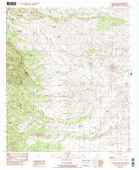
2017 Clanton Draw
Hidalgo County, NM
2017 Corner Well
Hidalgo County, NM
2017 Coyote Peak
Hidalgo County, NM
2017 Culberson Ranch
Hidalgo County, NM
2017 Dog Mountains
Hidalgo County, NM
2017 Double Wells
Hidalgo County, NM
2017 Doyle Peak
Hidalgo County, NM
2017 Eagle Mountain
Hidalgo County, NM
2017 Fitzpatricks
Hidalgo County, NM
2017 Gary
Hidalgo County, NM
2017 Gillespie Mountain
Hidalgo County, NM
2017 Gold Hill
Hidalgo County, NM
2017 Guadalupe Pass
Hidalgo County, NM
2017 Guadalupe Spring
Hidalgo County, NM
2017 Hachita Peak
Hidalgo County, NM
2017 Hatchet Ranch
Hidalgo County, NM
2017 Hilo Peak
Hidalgo County, NM
2017 Horse Mountain
Hidalgo County, NM
2017 Indian Peak
Hidalgo County, NM
2017 Lang Canyon
Hidalgo County, NM
2017 Lisbon
Hidalgo County, NM
2017 Mondel
Hidalgo County, NM
2017 Mount Baldy
Hidalgo County, NM
2017 Muir Ranch
Hidalgo County, NM
2017 Ninemile Hill
Hidalgo County, NM
2017 Pierce Peak
Hidalgo County, NM
2017 Playas Lake North
Hidalgo County, NM
2017 Playas Lake South
Hidalgo County, NM
2017 Pyramid Peak
Hidalgo County, NM
2017 Rock Tank Draw
Hidalgo County, NM
2017 San Luis Pass
Hidalgo County, NM
2017 San Simon Cienega
Hidalgo County, NM
2017 Sentinel Butte
Hidalgo County, NM
2017 Sheridan Canyon
Hidalgo County, NM
2017 Skeleton Canyon
Hidalgo County, NM
2017 Skull Canyon
Hidalgo County, NM
2017 South Pyramid Peak
Hidalgo County, NM
2017 Steins
Hidalgo County, NM
2017 Summit
Hidalgo County, NM
2017 Swallow Fork Peak
Hidalgo County, NM
2017 Table Top Mountain
Hidalgo County, NM
2017 Tank Mountain
Hidalgo County, NM
2017 U Bar Ridge
Hidalgo County, NM
2017 Walnut Wells NE
Hidalgo County, NM
2017 Whitewater Creek
Hidalgo County, NM
2017 Whitewater Mountains
Hidalgo County, NM
2017 Whitmire Pass
Hidalgo County, NM
2017 Willow Draw
Hidalgo County, NM
2020 Animas Peak
Hidalgo County, NM
2020 Animas Peak NE
Hidalgo County, NM
2020 Antelope Pass
Hidalgo County, NM

2020 Beacon Hill
Hidalgo County, NM
2020 Big Hatchet Peak
Hidalgo County, NM
2020 Black Point
Hidalgo County, NM
2020 Cabin Wells
Hidalgo County, NM
2020 Campbell Well
Hidalgo County, NM
2020 Canador Peak
Hidalgo County, NM
2020 Caprock Mountain
Hidalgo County, NM
2020 Center Peak
Hidalgo County, NM
2020 Clanton Draw
Hidalgo County, NM
2020 Corner Well
Hidalgo County, NM
2020 Coyote Peak
Hidalgo County, NM
2020 Culberson Ranch
Hidalgo County, NM
2020 Dog Mountains
Hidalgo County, NM
2020 Double Wells
Hidalgo County, NM
2020 Doyle Peak
Hidalgo County, NM
2020 Eagle Mountain
Hidalgo County, NM
2020 Fitzpatricks
Hidalgo County, NM
2020 Gary
Hidalgo County, NM
2020 Gillespie Mountain
Hidalgo County, NM
2020 Gold Hill
Hidalgo County, NM
2020 Guadalupe Pass
Hidalgo County, NM
2020 Guadalupe Spring
Hidalgo County, NM
2020 Hachita Peak
Hidalgo County, NM
2020 Hatchet Ranch
Hidalgo County, NM
2020 Hilo Peak
Hidalgo County, NM
2020 Horse Mountain
Hidalgo County, NM
2020 Indian Peak
Hidalgo County, NM
2020 Lang Canyon
Hidalgo County, NM
2020 Lisbon
Hidalgo County, NM
2020 Mondel
Hidalgo County, NM
2020 Mount Baldy
Hidalgo County, NM
2020 Muir Ranch
Hidalgo County, NM
2020 Ninemile Hill
Hidalgo County, NM
2020 Pierce Peak
Hidalgo County, NM
2020 Playas Lake North
Hidalgo County, NM
2020 Playas Lake South
Hidalgo County, NM
2020 Pyramid Peak
Hidalgo County, NM
2020 Rock Tank Draw
Hidalgo County, NM
2020 San Luis Pass
Hidalgo County, NM
2020 San Simon Cienega
Hidalgo County, NM
2020 Sentinel Butte
Hidalgo County, NM
2020 Sheridan Canyon
Hidalgo County, NM
2020 Skeleton Canyon
Hidalgo County, NM
2020 Skull Canyon
Hidalgo County, NM
2020 South Pyramid Peak
Hidalgo County, NM
2020 Steins
Hidalgo County, NM
2020 Summit
Hidalgo County, NM
2020 Swallow Fork Peak
Hidalgo County, NM
2020 Table Top Mountain
Hidalgo County, NM
2020 Tank Mountain
Hidalgo County, NM
2020 U Bar Ridge
Hidalgo County, NM
2020 Walnut Wells NE
Hidalgo County, NM
2020 Whitewater Creek
Hidalgo County, NM
2020 Whitewater Mountains
Hidalgo County, NM
2020 Whitmire Pass
Hidalgo County, NM
2020 Willow Draw
Hidalgo County, NM
2023 Animas Peak
Hidalgo County, NM
2023 Animas Peak NE
Hidalgo County, NM
2023 Antelope Pass
Hidalgo County, NM
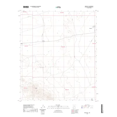
2023 Beacon Hill
Hidalgo County, NM
2023 Big Hatchet Peak
Hidalgo County, NM
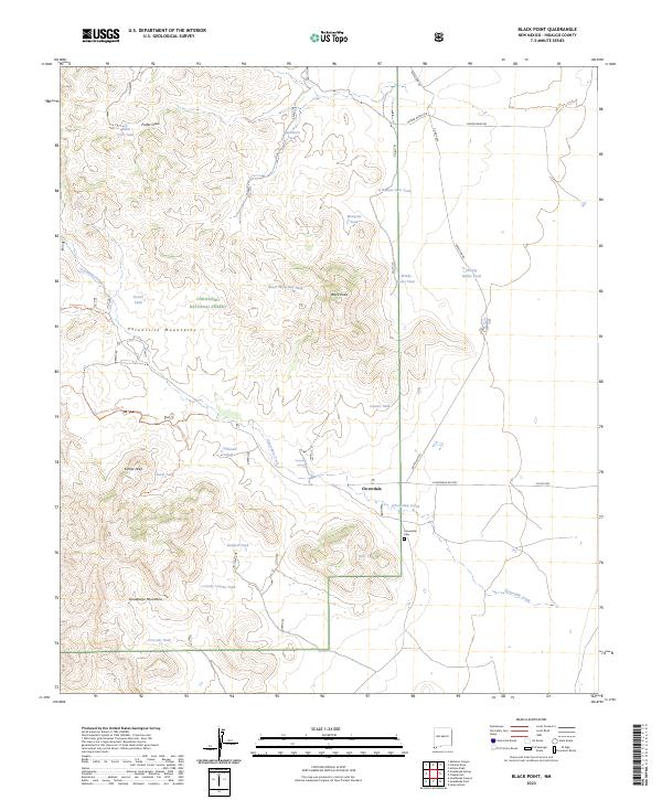
2023 Black Point
Hidalgo County, NM
2023 Cabin Wells
Hidalgo County, NM
2023 Campbell Well
Hidalgo County, NM
2023 Canador Peak
Hidalgo County, NM
2023 Caprock Mountain
Hidalgo County, NM
2023 Center Peak
Hidalgo County, NM
2023 Clanton Draw
Hidalgo County, NM
2023 Corner Well
Hidalgo County, NM
2023 Coyote Peak
Hidalgo County, NM
2023 Culberson Ranch
Hidalgo County, NM
2023 Dog Mountains
Hidalgo County, NM
2023 Double Wells
Hidalgo County, NM
2023 Doyle Peak
Hidalgo County, NM
2023 Eagle Mountain
Hidalgo County, NM
2023 Fitzpatricks
Hidalgo County, NM
2023 Gary
Hidalgo County, NM
2023 Gillespie Mountain
Hidalgo County, NM
2023 Gold Hill
Hidalgo County, NM
2023 Guadalupe Pass
Hidalgo County, NM
2023 Guadalupe Spring
Hidalgo County, NM
2023 Hachita Peak
Hidalgo County, NM
2023 Hatchet Ranch
Hidalgo County, NM
2023 Hilo Peak
Hidalgo County, NM
2023 Horse Mountain
Hidalgo County, NM
2023 Indian Peak
Hidalgo County, NM
2023 Lang Canyon
Hidalgo County, NM
2023 Lisbon
Hidalgo County, NM
2023 Mondel
Hidalgo County, NM
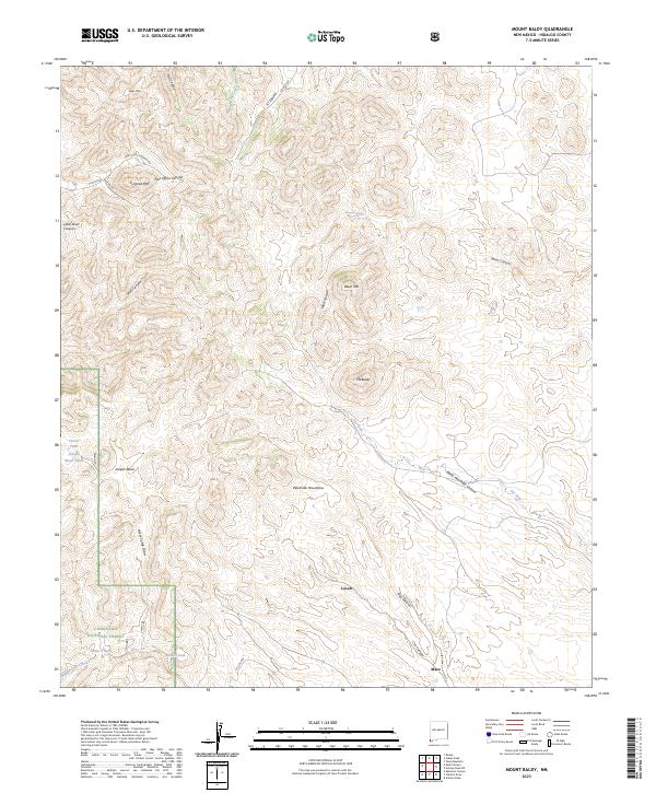
2023 Mount Baldy
Hidalgo County, NM
2023 Muir Ranch
Hidalgo County, NM
2023 Ninemile Hill
Hidalgo County, NM
2023 Pierce Peak
Hidalgo County, NM
2023 Playas Lake North
Hidalgo County, NM
2023 Playas Lake South
Hidalgo County, NM
2023 Pyramid Peak
Hidalgo County, NM
2023 Rock Tank Draw
Hidalgo County, NM
2023 San Luis Pass
Hidalgo County, NM
2023 San Simon Cienega
Hidalgo County, NM
2023 Sentinel Butte
Hidalgo County, NM
2023 Sheridan Canyon
Hidalgo County, NM
2023 Skeleton Canyon
Hidalgo County, NM
2023 Skull Canyon
Hidalgo County, NM
2023 South Pyramid Peak
Hidalgo County, NM
2023 Steins
Hidalgo County, NM
2023 Summit
Hidalgo County, NM
2023 Swallow Fork Peak
Hidalgo County, NM
2023 Table Top Mountain
Hidalgo County, NM

2023 Tank Mountain
Hidalgo County, NM
2023 U Bar Ridge
Hidalgo County, NM
2023 Walnut Wells NE
Hidalgo County, NM
2023 Whitewater Creek
Hidalgo County, NM
2023 Whitewater Mountains
Hidalgo County, NM
2023 Whitmire Pass
Hidalgo County, NM
2023 Willow Draw
Hidalgo County, NM