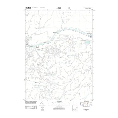
2011 Map of Clarendon
USGS Topo · Published 2011About this map
Clarendon and its surrounding communities sit along the transition from the winding Allegheny River to the upland forests of the northern Allegheny plateau. This 2011 survey documents the complex infrastructure that defines the modern landscape, including the Kinzua Dam and the massive Seneca Pumped Storage Area perched above the river. The map details a string of settlements established along the valley corridors, from the distinct residential clusters of Clarendon Heights and Old Clarendon to the smaller hamlets of Weldbank, Stoneham, and Rogertown.
Find a feature on this map
66 named features on this map. Tap any name to fly to it.
Don’t see what you’re looking for? This feature index may not catch every label — zoom into the map to look around manually.
Map Details
Editions of this 2011 Clarendon Map
This is the sole edition of this map. No revisions or reprints were ever made.
Other maps of this area

1906 · Warren
USGS Topo · 1:62,500

1907 · Warren
USGS Topo · 1:62,500

1908 · Warren
USGS Topo · 1:62,500

1934 · Kane
USGS Topo · 1:48,000

1935 · Sheffield
USGS Topo · 1:48,000

1936 · Kinzua
USGS Topo · 1:48,000

1939 · Kane
USGS Topo · 1:62,500

1941 · Sheffield
USGS Topo · 1:62,500

1941 · Kinzua
USGS Topo · 1:62,500

1947 · Cherry Grove
USGS Topo · 1:24,000