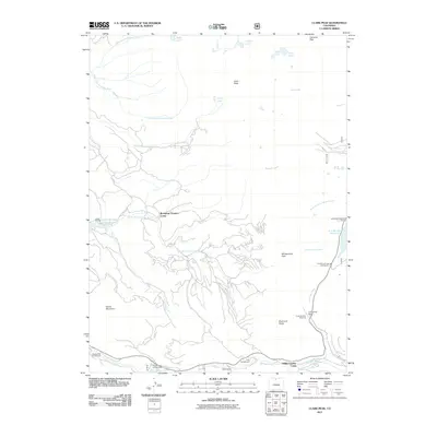
2011 Map of Clark Peak
USGS Topo · Published 2011About this map
Clark Peak and Cameron Peak dominate this high-altitude landscape in the Colorado mountains, where the headwaters of the North Fork Canadian River and the Michigan River divide the terrain. The presence of the Bockman Lumber Camp and Willey Lumber Camp indicates the historical importance of the timber industry in these forests, while the M-M Cabins and several campgrounds like Middle Fork Campground suggest a long-standing tradition of seasonal residence and recreation. Transport through this high country is dictated by major gaps in the range, most notably Cameron Pass and Montgomery Pass. Water management is evident through early 21st-century infrastructure such as the Upper Michigan Ditch and the North Michigan Creek Reservoir, which redirect and store snowmelt for downstream use. This survey also records numerous high-mountain lakes, including Jewel Lake, Kelly Lake, and Timber Lake, which serve as landmarks in the sparsely settled backcountry.
Find a feature on this map
39 named features on this map. Tap any name to fly to it.
Don’t see what you’re looking for? This feature index may not catch every label — zoom into the map to look around manually.
Map Details
Editions of this 2011 Clark Peak Map
This is the sole edition of this map. No revisions or reprints were ever made.
Other maps of this area

1915 · Longs Peak
USGS Topo · 1:125,000

1916 · Home
USGS Topo · 1:125,000

1919 · Rocky Mountain National Park
USGS Topo · 1:125,000

1920 · Home
USGS Topo · 1:125,000

1954 · Greeley
USGS Topo · 1:250,000

1954 · Craig
USGS Topo · 1:250,000

1955 · Gould
USGS Topo · 1:24,000

1956 · Johnny Moore Mountain
USGS Topo · 1:24,000

1956 · Jack Creek Ranch
USGS Topo · 1:24,000

1956 · Rand
USGS Topo · 1:62,500