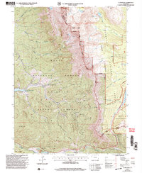
2000 Map of Clark Peak
USGS Topo · Published 2004About this map
Clark Peak dominates this high-altitude landscape along the border of Jackson and Larimer counties, where several major wilderness and forest boundaries converge. The area’s late 20th-century character is defined by its transition from industrial resource extraction to state-managed recreation and conservation. Evidence of the timber era remains at the Bockman Lumber Camp, while the administrative presence is marked by the State Forest Headquarters and the Ranger Lakes area.
Find a feature on this map
43 named features on this map. Tap any name to fly to it.
Don’t see what you’re looking for? This feature index may not catch every label — zoom into the map to look around manually.
Map Details
Editions of this 2000 Clark Peak Map
This is the sole edition of this map. No revisions or reprints were ever made.
Other maps of this area

1915 · Longs Peak
USGS Topo · 1:125,000

1916 · Home
USGS Topo · 1:125,000

1919 · Rocky Mountain National Park
USGS Topo · 1:125,000

1920 · Home
USGS Topo · 1:125,000

1954 · Greeley
USGS Topo · 1:250,000

1954 · Craig
USGS Topo · 1:250,000

1955 · Gould
USGS Topo · 1:24,000

1956 · Johnny Moore Mountain
USGS Topo · 1:24,000

1956 · Jack Creek Ranch
USGS Topo · 1:24,000

1956 · Rand
USGS Topo · 1:62,500