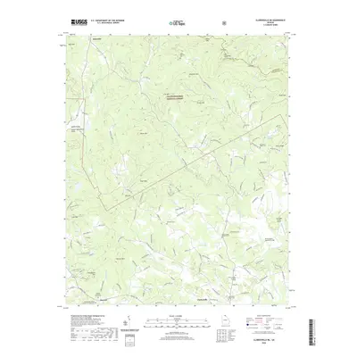
2020 Map of Clarkesville NE
USGS Topo · Published 2020About this map
Chattahoochee National Forest lands dominate this northern Georgia landscape, where the Soquee River and its numerous tributaries like Sutton Mill Cr carve through high terrain. The map details a community centered on small-scale settlements like Batesville, Harvest, and the northern outskirts of Clarkesville. Local history and genealogy are anchored by several country churches and burial grounds, including the Macedonia Baptist Cem and Alleys Chapel Methodist Cem.
Find a feature on this map
142 named features on this map. Tap any name to fly to it.
Don’t see what you’re looking for? This feature index may not catch every label — zoom into the map to look around manually.
Map Details
Editions of this 2020 Clarkesville NE Map
This is the sole edition of this map. No revisions or reprints were ever made.
Other maps of this area

1886 · Dahlonega
USGS Topo · 1:125,000

1886 · Walhalla
USGS Topo · 1:125,000

1892 · Dahlonega
USGS Topo · 1:125,000

1892 · Walhalla
USGS Topo · 1:125,000

1896 · Walhalla
USGS Topo · 1:125,000

1896 · Dahlonega
USGS Topo · 1:125,000

1903 · Dahlonega
USGS Topo · 1:125,000

1935 · Tray Mountain
USGS Topo · 1:24,000
1938 · Tray Mountain
USGS Topo · 1:24,000

1953 · Tallulah Falls
USGS Topo · 1:24,000