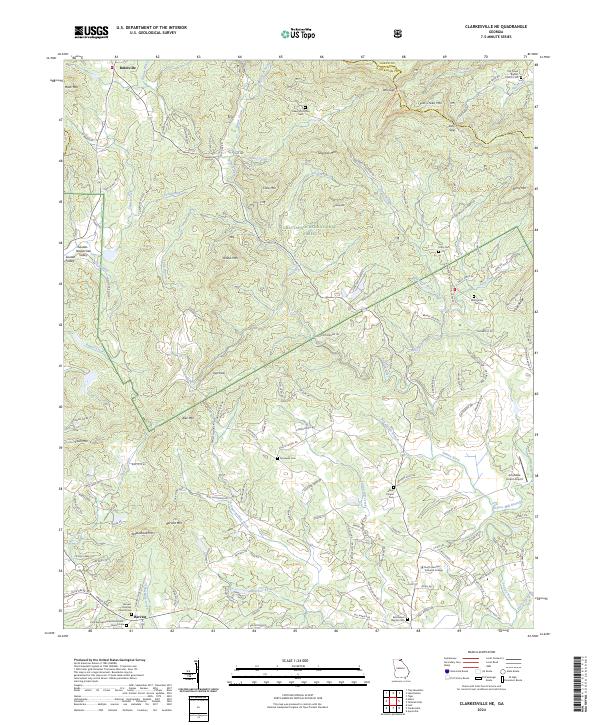
2024 Map of Clarkesville NE
USGS Topo · Published 2024About this map
The Chattahoochee National Forest blankets the foothills of the Blue Ridge in this corner of Northeast Georgia, where the Soque River and its numerous tributaries like Raper Creek and Beaverdam Creek carve through the high ground. The landscape is defined by its verticality, rising to summits such as Crow Mtn, Yellow Mtn, and Sillycook Mtn. Settlement is concentrated along the valleys and ridge roads, with the communities of Batesville and Harvest serving as local anchors.
Find a feature on this map
142 named features on this map. Tap any name to fly to it.
Don’t see what you’re looking for? This feature index may not catch every label — zoom into the map to look around manually.
Map Details
Editions of this 2024 Clarkesville NE Map
This is the sole edition of this map. No revisions or reprints were ever made.
Other maps of this area

1886 · Dahlonega
USGS Topo · 1:125,000

1886 · Walhalla
USGS Topo · 1:125,000

1892 · Dahlonega
USGS Topo · 1:125,000

1892 · Walhalla
USGS Topo · 1:125,000

1896 · Walhalla
USGS Topo · 1:125,000

1896 · Dahlonega
USGS Topo · 1:125,000

1903 · Dahlonega
USGS Topo · 1:125,000

1935 · Tray Mountain
USGS Topo · 1:24,000
1938 · Tray Mountain
USGS Topo · 1:24,000

1953 · Tallulah Falls
USGS Topo · 1:24,000