2023 Map of Clarksburg
USGS Topo · Published 2023About this map
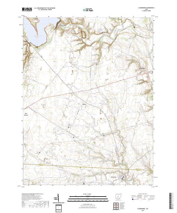
Clarksburg and Williamsport anchor this landscape along the border of Pickaway and Ross Counties, where the land transitions from the high ground of Tick Ridge down to the fertile plains fed by Deer Creek. The map reveals a high density of family burial grounds and farmstead cemeteries, such as Arron Kellar Farm Cem and Arthur Dunlap Farm Cem, which point to a deep history of private landownership and multi-generational agriculture. The northern reaches are dominated by Deer Creek Lake, a significant water feature that has reshaped the local drainage of Buskirk Creek and State Run. The settlement pattern follows established routes like the New Holland Clarksburg Rd, connecting rural hamlets such as Atlanta to the larger village centers. This survey is particularly useful for genealogists, as it meticulously labels numerous small, often-overlooked cemeteries like Tanquary Cem and Lutz Cem scattered throughout the countryside.
Find a feature on this map
71 named features on this map. Tap any name to fly to it.
Don’t see what you’re looking for? This feature index may not catch every label — zoom into the map to look around manually.
Map Details
Editions of this 2023 Clarksburg Map
This is the sole edition of this map. No revisions or reprints were ever made.
