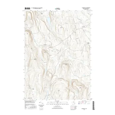
2016 Map of Clarksville
USGS Topo · Published 2016About this map
The Helderberg Mountains define the western reaches of this Albany County landscape, where elevation changes dramatically near Cass Hill and Wolf Hill. Central to the area is the village of Clarksville, situated along the winding course of Onesquethaw Cr. This topography, characterized by numerous named peaks like Copeland Hill and Bennett Hill, has historically dictated the settlement patterns and road networks that connect the smaller hamlets of New Salem and Unionville.
Find a feature on this map
97 named features on this map. Tap any name to fly to it.
Don’t see what you’re looking for? This feature index may not catch every label — zoom into the map to look around manually.
Map Details
Editions of this 2016 Clarksville Map
This is the sole edition of this map. No revisions or reprints were ever made.
Other maps of this area

1893 · Coxsackie
USGS Topo · 1:62,500

1893 · Durham
USGS Topo · 1:62,500

1893 · Albany
USGS Topo · 1:62,500

1894 · Coxsackie
USGS Topo · 1:62,500

1894 · Durham
USGS Topo · 1:62,500

1895 · Albany
USGS Topo · 1:62,500

1898 · Albany
USGS Topo · 1:62,500

1900 · Berne
USGS Topo · 1:62,500

1903 · Berne
USGS Topo · 1:62,500

1927 · Albany
USGS Topo · 1:62,500