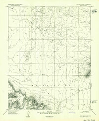
1952 Map of Clay Hills 4 SW
USGS Topo · Published 1952About this map
Navajo Indian Reservation lands dominate this mid-century landscape, characterized by isolated traditional dwellings and emerging industrial activity. The Goulding Trading Post serves as a primary focal point near the southern border, situated at the base of the dramatic topography where Horse Pasture Canyon meets the flats. Nearby, a Landing Strip and the Skyline Mine indicate the era's mineral exploration and logistical reach into this corner of San Juan County.
Find a feature on this map
14 named features on this map. Tap any name to fly to it.
Don’t see what you’re looking for? This feature index may not catch every label — zoom into the map to look around manually.
Map Details
Editions of this 1952 Clay Hills 4 SW Map
2 editions found
Other maps of this area

1883 · Marsh Pass
USGS Topo · 1:250,000

1886 · Henry Mountains
USGS Topo · 1:250,000

1892 · Marsh Pass
USGS Topo · 1:250,000

1892 · Henry Mountains
USGS Topo · 1:250,000

1952 · Clay Hills 4 SW
USGS Topo · 1:24,000

1952 · Clay Hills 3 SE
USGS Topo · 1:24,000

1952 · Agathla Peak 1 NW
USGS Topo · 1:24,000

1952 · Boot Mesa
USGS Topo · 1:62,500

1952 · Clay Hills 4 SE
USGS Topo · 1:24,000

1952 · Agathla Peak 1 NE
USGS Topo · 1:24,000