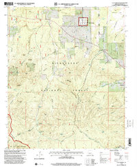
1998 Map of Clay Springs
USGS Topo · Published 2000About this map
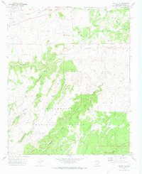
Sitgreaves National Forest dominates this high-elevation landscape, where the dramatic Mogollon Rim forms a natural boundary in the southwest corner. The small community of Clay Springs serves as a focal point near the northern edge, while Pinedale anchors the eastern side of the sheet. Between these settlements, the land is etched by deep drainage systems like Stinson Wash and Pinedale Canyon, which define the local topography.
Find a feature on this map
82 named features on this map. Tap any name to fly to it.
Don’t see what you’re looking for? This feature index may not catch every label — zoom into the map to look around manually.
Map Details
Editions of this 1998 Clay Springs Map
This is the sole edition of this map. No revisions or reprints were ever made.
Other maps of this area

1886 · Holbrook
USGS Topo · 1:250,000

1893 · Holbrook
USGS Topo · 1:250,000

1954 · Holbrook
USGS Topo · 1:250,000

1957 · Holbrook
USGS Topo · 1:250,000

1958 · Holbrook
USGS Topo · 1:250,000

1960 · Holbrook
USGS Topo · 1:250,000
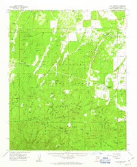
1961 · Clay Springs
USGS Topo · 1:62,500
1961 · Show Low
USGS Topo · 1:62,500
1961 · Cibecue
USGS Topo · 1:62,500
1970 · Cactus Flat
USGS Topo · 1:24,000