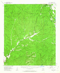
1961 Map of Show Low
USGS Topo · Published 1963About this map
Show Low sits at the northern edge of this high-plateau survey, positioned where the high desert meets the dense timber of the Sitgreaves National Forest. The map documents a pivotal era of infrastructure development along the Mogollon Rim, featuring the Radio Sta (KVWM) and a Pumping Sta Aqueduct near Show Low Lake. The southern half of the sheet is dominated by the Fort Apache Indian Reservation, where the landscape drops into a complex network of drainages like Corduroy Creek and Cedar Creek. Local commerce and transit are anchored by the Forestdale Trading Post and a small Airstrip, while remote outposts such as West Ranch and Little Spring Ranch highlight the area's legacy of ranching. Numerous small water catchments, including Hansen Tank and Old Scott Tank, reflect the essential water management required for livestock in this high-altitude environment.
Find a feature on this map
99 named features on this map. Tap any name to fly to it.
Don’t see what you’re looking for? This feature index may not catch every label — zoom into the map to look around manually.
Map Details
Editions of this 1961 Show Low Map
2 editions found
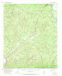
Other maps of this area

1886 · St Johns
USGS Topo · 1:250,000

1886 · Holbrook
USGS Topo · 1:250,000

1892 · St Johns
USGS Topo · 1:250,000

1893 · Holbrook
USGS Topo · 1:250,000

1954 · Holbrook
USGS Topo · 1:250,000

1954 · Clifton
USGS Topo · 1:250,000

1954 · Saint Johns
USGS Topo · 1:250,000

1954 · Mesa
USGS Topo · 1:250,000

1957 · Mesa
USGS Topo · 1:250,000

1957 · Holbrook
USGS Topo · 1:250,000